MAPS OF EAST FEN
MAP NO 1
Location of Toynton St Peter and Toynton All Saints
MAP NO 1
Location of Toynton St Peter and Toynton All Saints
MAP NO 2
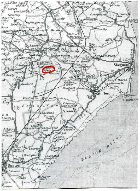
The following map of Fenland shows Toynton St Peter and Toynton All Saints (with the red dots) on the very northern boundary.
The following map of Fenland shows Toynton St Peter and Toynton All Saints (with the red dots) on the very northern boundary.
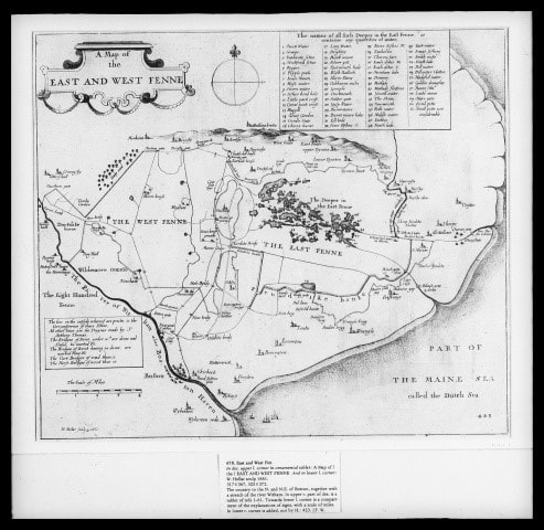
MAP N0 3
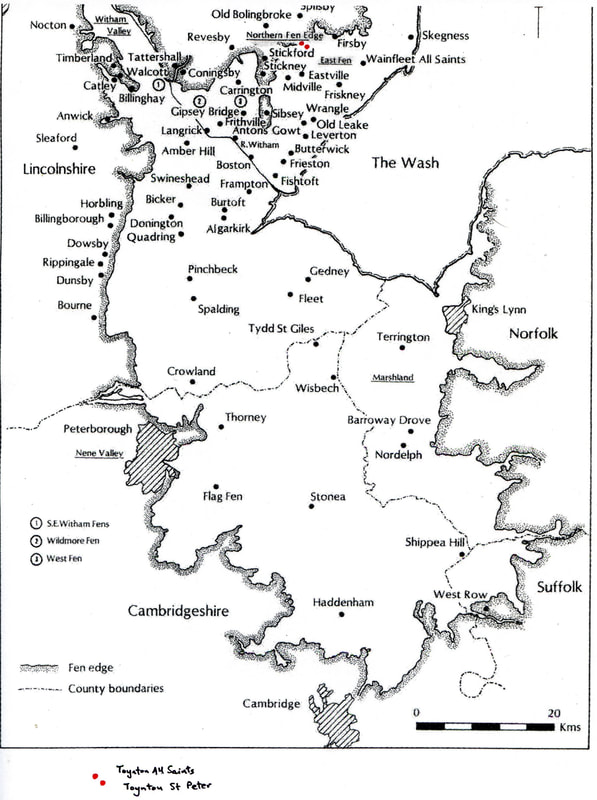
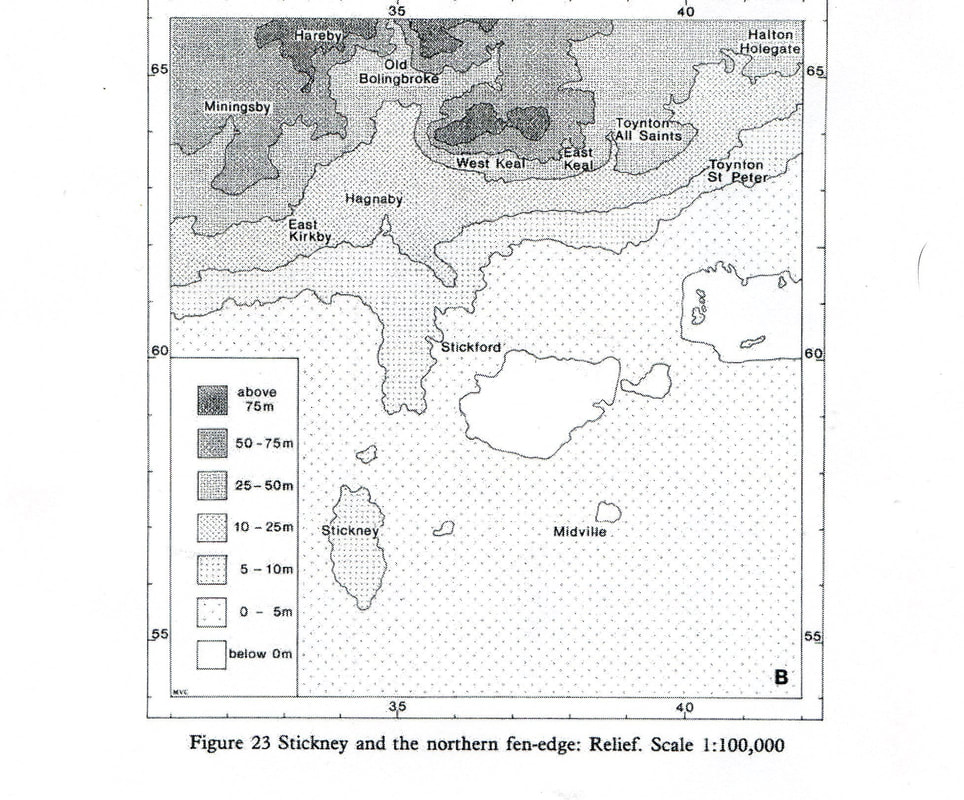
The topography of the area can be seen from a map in The Fenland Project Number 8: Lincolnshire Survey: The Northern Fen Edge by T. W. Lane at East Anglian Archaeology.
The topography of the area can be seen from a map in The Fenland Project Number 8: Lincolnshire Survey: The Northern Fen Edge by T. W. Lane at East Anglian Archaeology.
A quotation from Man and his Past by O.G.S. Crawford starts the Introduction to The Fenland Project No 8:
“To know everything possible about the men of a given epoch it is necessary also to study their environment. This must be restored and portrayed in the form of maps”
The Introduction ends with … “the story of the northern fens is one of people making precarious livings from harsh environments”.
HISTORICAL MAPS
There are a number of old maps, starting with the one that follows, that give a good idea of how the villages lie with East Fen to the south and the Wolds to the north.
MAP NO 4 Lincoln Central Library FA2
R C Wheeler Map No 4 in his Maps of the Witham Fens. All the maps in this book have been here reduced in quality. The book itself has very sharp and larger images.
"A Map of the Levell North East from Boston” dated 1585?
The villages were then named as High Toynton and Low Toynton.
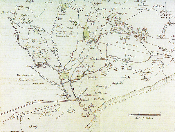
MAP NO 5 Lincoln Central Library FA3
R C Wheeler Map No 8 in his Maps of the Witham Fens
“The Description of Wildmore Fenn, West Fenn and East Fenn etc” dated c1661.
The boundary of the Soke of Bolingbroke shown in green.
The two Toynton villages are shown as churches.
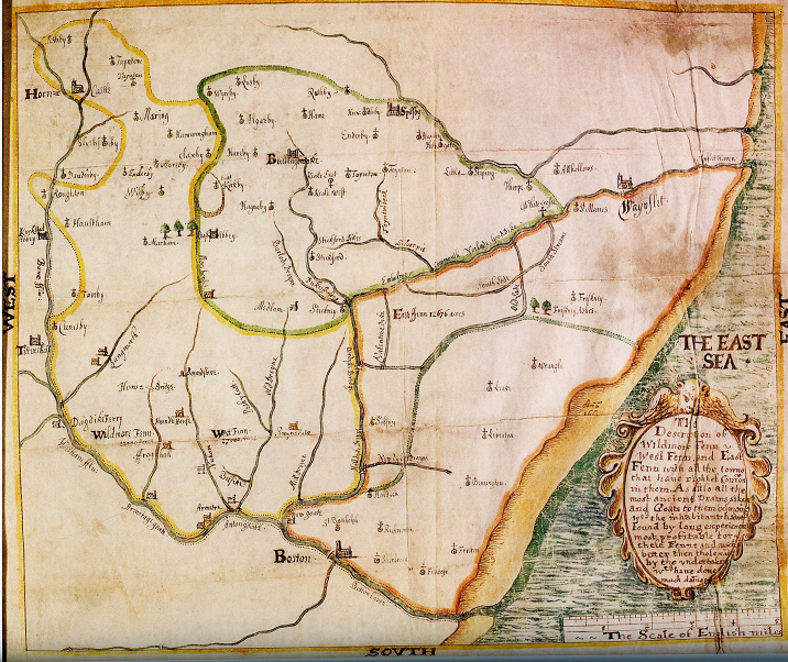
MAP NO 6
R C Wheeler Map No 7 in his Maps of the Witham Fens
“A Description of Wildmore Fen, West Fen and East Fen etc” dated 1664 by Wenceslaus Hollar and included in Sir William Dugdale’s History of Drayning and Embanking. It shows the two villages as Upper Toynton (All Saints) and Lower Toynton (St Peter) and indicates the two churches.
Hollar even sketches the edge of the high ground of the Wolds on the northern boundary of the fen.
It also schedules all the “Deepes” of East Fen.
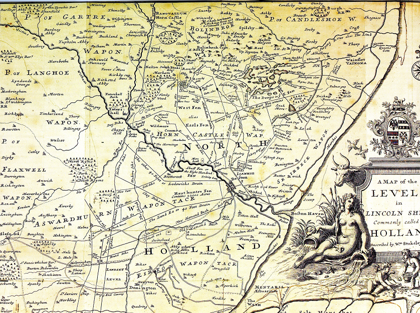
MAP NO 7
Lincolnshire Archives “Stukeley’s Plan of Holland Levels 1723 Ref FL/Maps/36
R C Wheeler map No 12 in his Maps of the Witham Fens
A Map of the Levels in Lincolnshire commonly called Holland by William Stukeley dated 1723. Herman Moll was the engraver and cosmographer (the science of mapmaking). As Herman Moll acknowledges, William Stukeley (an antiquarian) presented him with the design of the 1723 map. By this he obviously meant the internal Roman Road layout which had been part of the research by William Stukeley at the Society of Antiquaries. This information came from several documents of Roman origin. (cartographyunchained.com).
There is a dotted line which indicates the boundary of the Soke of Bolingbroke. Again, the two villages are marked as Upper Toyton and Lower Toynton.
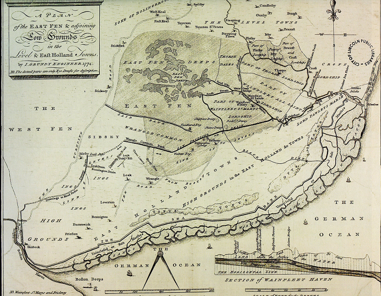
MAP NO 8 Lincoln Central Library Map 77
R C Wheeler Map No 37 in his Maps of the Witham Fens
“A Plan of the East Fen and Surrounding Grounds etc” by Grundy dated 1774. The engraver was M Darby. Accompanied a report and estimate for proposed drainage to run to Wainfleet Haven. The scheme was never adopted.
The Deeps are shown and the two Toynton villages just north of the shaded area.
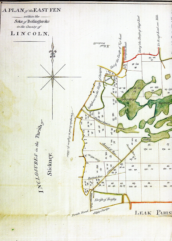
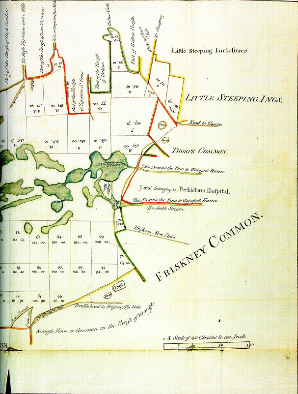
MAP NO 9 Lincoln Central Library FA4
R C Wheeler Map No 43 in his Maps of the Witham Fens
“A Plan of the East Fen within the Soke of Bolingbroke”. Possibly 1778/9. Accompanied a very early proposal for Enclosure. Not adopted. Shows the Deeps as being excluded from enclosure.
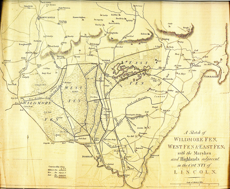
MAP NO 10 Lincolnshire Archives Smith 9/2/15
R C Wheeler Map No 59 (ii) in his Maps of the Witham Fens
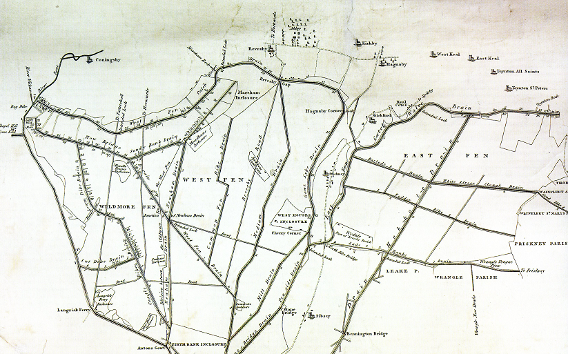
“A Sketch of Wildmore Fen, West fen and East Fen etc”. From Sir John Rennie’s “Report concerning the drainage of Wildmore Fen, and of the East and West Fens” 7th April 1800. Shows the proposals for new drains including the East Fen Catchwater Drain (running westwards from the north east of East Fen before turning south). The Hobhole Drain that now runs north to south through the centre of East fen has still not been devised. The Toynton villages are shown at the edge of the Wolds escarpment.
MAP NO 11 Lincoln Central Library Map 102
R C Wheeler Map No 94:1 in his Maps of the Witham Fens
“A Plan of the Drains that are to be converted into Navigations through the East, West and Wildmore Fens in the County of Lincoln” by A Bower 1811.
MAP NO 12 British Library OSD279
R C Wheeler Map No 126.5 in his Maps of the Witham Fens
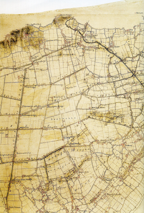
An extract from the MS Drawing for OS Old Series Published 1825 Originally completed 1813, Revised 1821 (see also Cassini Map below) by C Budgen 1821. The two Toynton villages are now properly named.
Most remarkably, the Ordnance Survey of the East, West and Wildmore Fens was based upon such a composite map, drawn up about 1813 by the surveyor Charles Budgen and updated later. His drawing is particularly valuable in showing allotment boundaries as they stood no later than 1813 but buildings as they were in 1821.
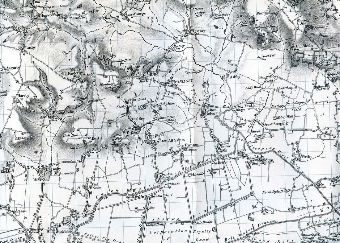
MAP NO 13 Cassini Publishing Ltd
The Cassini Historical Map – Old Series 1824 – No 122 Skegness and Horncastle.
Copyright Cassini Publishing Ltd, www.cassinimaps.com
This map now shows the new drainage systems and the loss of The Deeps in East Fen. The shading on the map indicates the higher ground of the Lincolnshire Wolds.
MAP NO 14 Lincolnshire Archives Lindsey Awards 205 9 ANC 8/3/6
R C Wheeler Map No 197.1 in his Maps of the Witham Fens
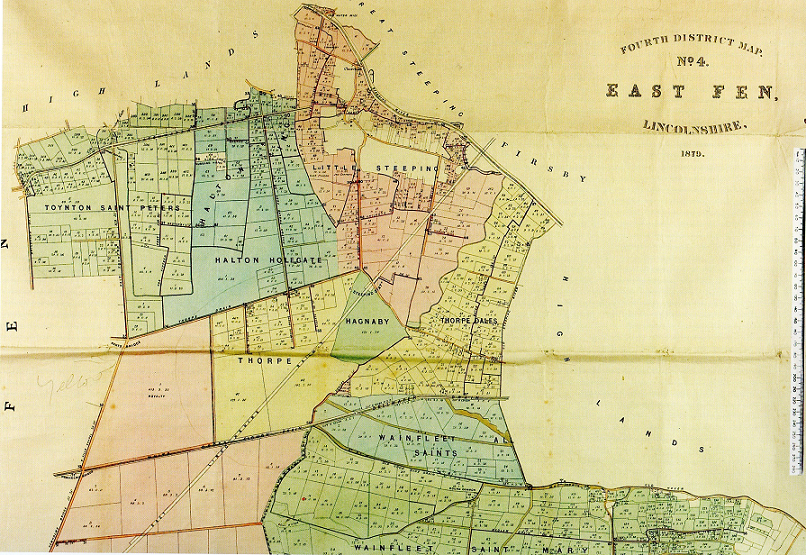
The enclosure maps had a long history, culminating in this glorious lithographed version which serves as the clearest record of the new landscapes created in the early nineteenth century. In the case of the East Fen they include lands not anciently part of the Fen but which by that date drained as part of it.
“Fourth District Map No 3 East Fen Lincolnshire” by James Martin, Surveyor dated 1879. All the new drains are shown with the layout of the new fields. Partly showing new enclosures and landowners.
MAP NO 15 Lincolnshire Central Library Maps 159
R C Wheeler Map No 202 in his Maps of the Witham Fens
Dated 1882 but representative of Rennie’s scheme of 1800 for draining East Fen.
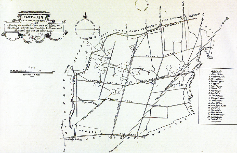
East Fen Plan after the Enclosure in 1810. Showing the ancient Deeps and the Rows or Boatings. The Deeps are all numbered and referenced on the schedule to the right. Also, the Hobhole Drain and the new roads laid out at the time.
MODERN MAPS
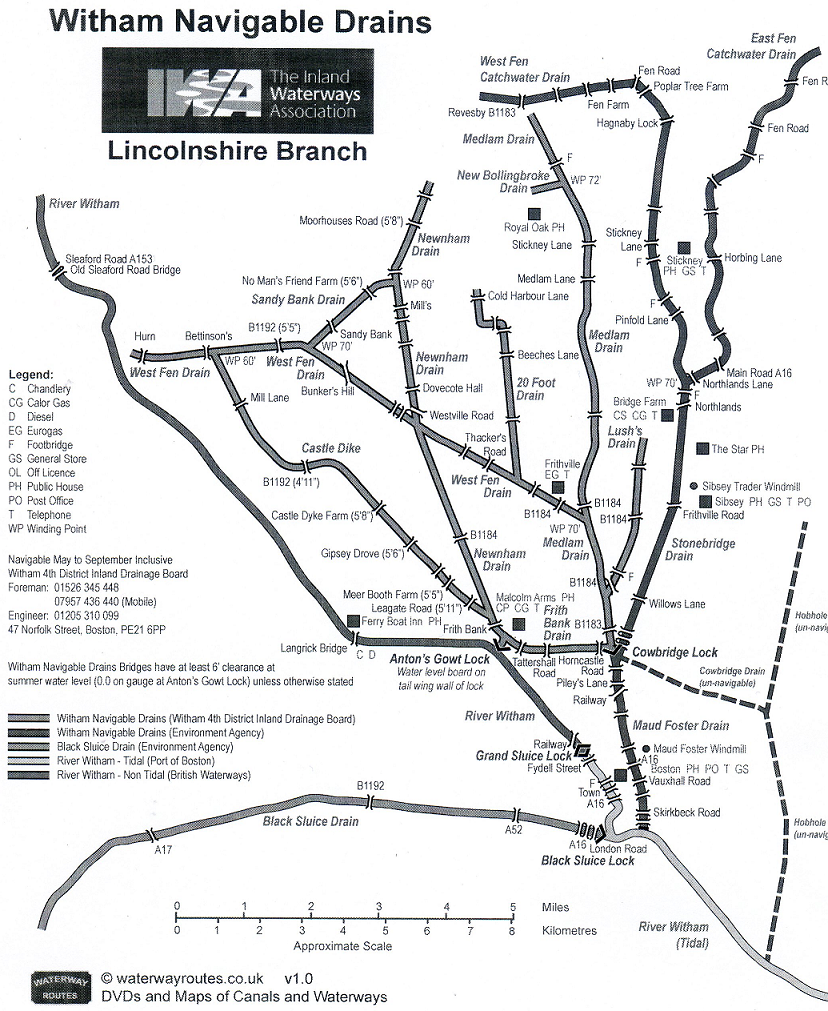
MAP NO 16 The Inland Waterways Association
Modern map of those drains that are still navigable. Note the Hobhole Drain is not navigable.
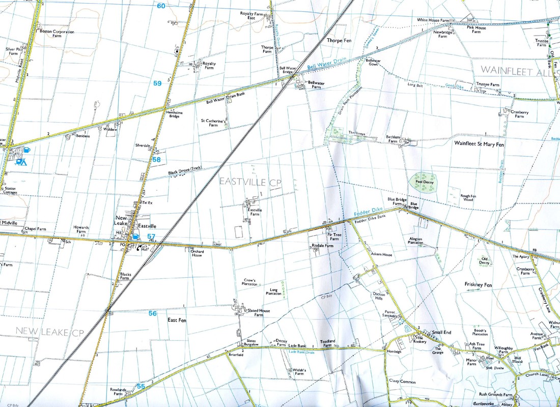
MAP NO 17 Ordnance Survey OS Explorer Map No 274 Skegness, Alford and Spilsby
Toynton St Peter and Toynton All Saints with the East Fen Catchwater Drain running east to west and shown in blue. In the lower left is the beginning of the Hobhole Drain shown in green where it starts at Boundary Farm.
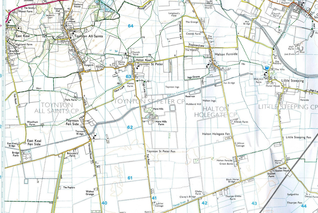
The Hobhole Drain continues south on the extract below following Midville Road. The Bellwater Drain feeds into the Hobhole Drain. At the bottom is Lade Bank.