THE LANDSCAPE – WHERE THE WOLDS MEET THE FEN
THE LINCOLNSHIRE FENS
The Fens, that great chunk of eastern England extending from Boston in Lincolnshire right down to Cambridge, encompass some of the most productive farmland in Europe. Give or take the occasional hillock, this pancake-flat, treeless terrain has been painstakingly reclaimed from the marshes and swamps which once drained into the intrusive stump of The Wash, a process that has taken almost two thousand years Nonetheless, the Lincolnshire Fens remain a distinctive area, with a scattering of introverted little villages spread across the flatlands.
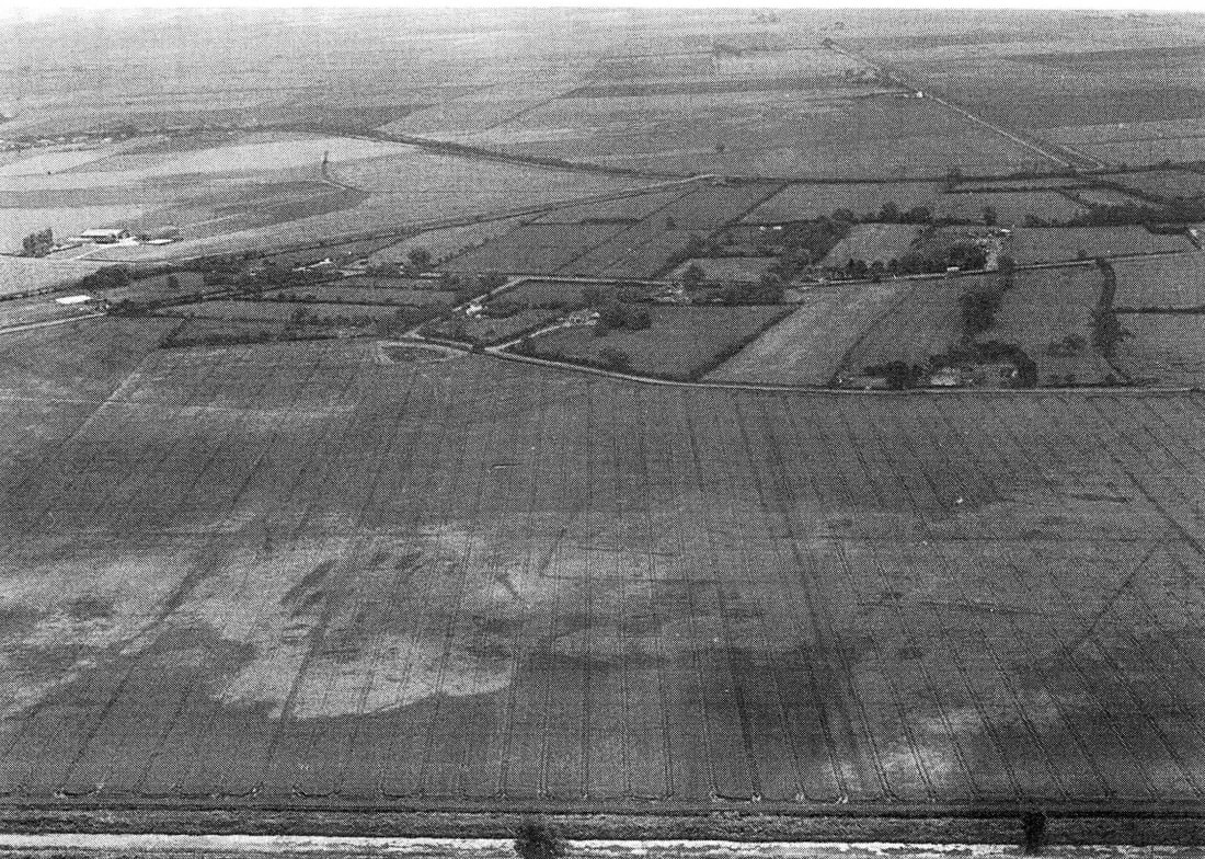
R C Wheeler in his Maps of the Witham Fens tells us: East of the West Fen, Stickney and Sibsey occupy a tongue (or strip north to south) of high land, and then comes the East Fen, a wild expanse devoid of settlement but with a great many “deeps”, permanent bodies of water created by peat digging (extraction), Lincolnshire’s lost version of the Norfolk Broads. Originally the East Fen drained to the east to Wainfleet Haven.
It hardly drained at all, but the roddons, the dried raised bed of a watercourse (such as a river or tidal-creek) shown on the Lidar that follows, do drain west to east.
S J (Steve) Malone in his publication Lincolnshire Fenland Lidar (Heritage Trust of Lincolnshire / Archaeological Project Services) describes Airborne Laser Altimetry or Lidar (Light Detection and Ranging) using laser light and GPS to produce horizontal and vertical accurate elevation measurements over a wide area. Aircraft and satellites are used for surveys. Steve Malone’s paper is freely available on the net and is extremely technical.
He explains:
The Drainage pattern within the Witham Valley provides an exemplar of that seen in the wider fenland. The silt filled former water courses (roddons) stand higher than the surrounding ground and the Lidar survey picks up the subtle changes in elevation of this peculiar inverted relief. The formation mechanism of the roddons remains imperfectly understood but they show particularly clearly in areas of former peat fen where the drainage and desiccation has reduced ground levels (many of these areas now being at or below sea level) and shown as very pale or white shades in the overall plot).
The fine resolution of the roddon systems seen even with a 2m centred lidar is demonstrated well in East Fen, north east of Boston. Here an east-west system can be seen draining towards the coast at Wainfleet (and disappearing under later marine silts.) A later north-south system overlies this draining the southern edge of the fen towards Wrangle (Fig 7).
Joan Thirsk, in her book English Peasant Farming describes the landscape in the sixteenth century.
The most favoured region from the farming point of view was undoubtedly the southern end of the Wolds, deep and fertile loams merging into fenny ground.
In the extreme south where the Wolds dip gently into the fen, much of the chalk has been washed from the hillsides, bringing the underlying clay and Spilsby sandstone to the surface. This southern part of the Wolds is a gently undulating country, as sheltered and inviting to the present-day traveller as it was to the early settlers. It was densely settled by the Danes, and, on the Domesday map, appears as the most populous area of Lincolnshire. Although by the mid sixteenth century other regions of the marsh and fen competed with it, it remained extremely thickly settled.
Hitherto the inhabitants of the southern Wold villages had enjoyed unstinted common in East, West and Wildmore Fens, which lay like a broad carpet to the south of their parishes. Lands within the parish lay for the most part to tillage divided between two fields which were cropped in alternate years. It was the custom of these villages to depend on the fen for most of their summer pasturage, keeping the grasslands at home to provide hay against the winter.
THE LANDSCAPE OF EAST FEN
This area of fenland, most of it at about sea level, is bounded to the south west by the River Witham and to the south east by a low silt ridge of marine origin which separates it from The Wash. The northern boundary is defined by the Lincolnshire Wolds to the north, and Wainfleet and the Steeping River to the north east. East Fen is separated from West Fen by a strip of higher ground, some 7 miles (11 km) long and 0.5 miles (0.8 km) wide, on which are situated the villages of Stickford, Stickney and Sibsey. The A16 road now follows this higher ground which is glacial in origin. Historically, the south-western section of the West Fen close to the River Witham was called the Wildmore Fen, but hydraulically, they form a single fen.
At least until the eighteenth century the East Fen acted as an unpredictable store of water that might flood much of the Low Grounds; the Wolds to the north contributed much of that water as it ran down from that higher land.
In the introduction to his article In the Fens, Rex Sly perfectly describes the landscape of the Fens:
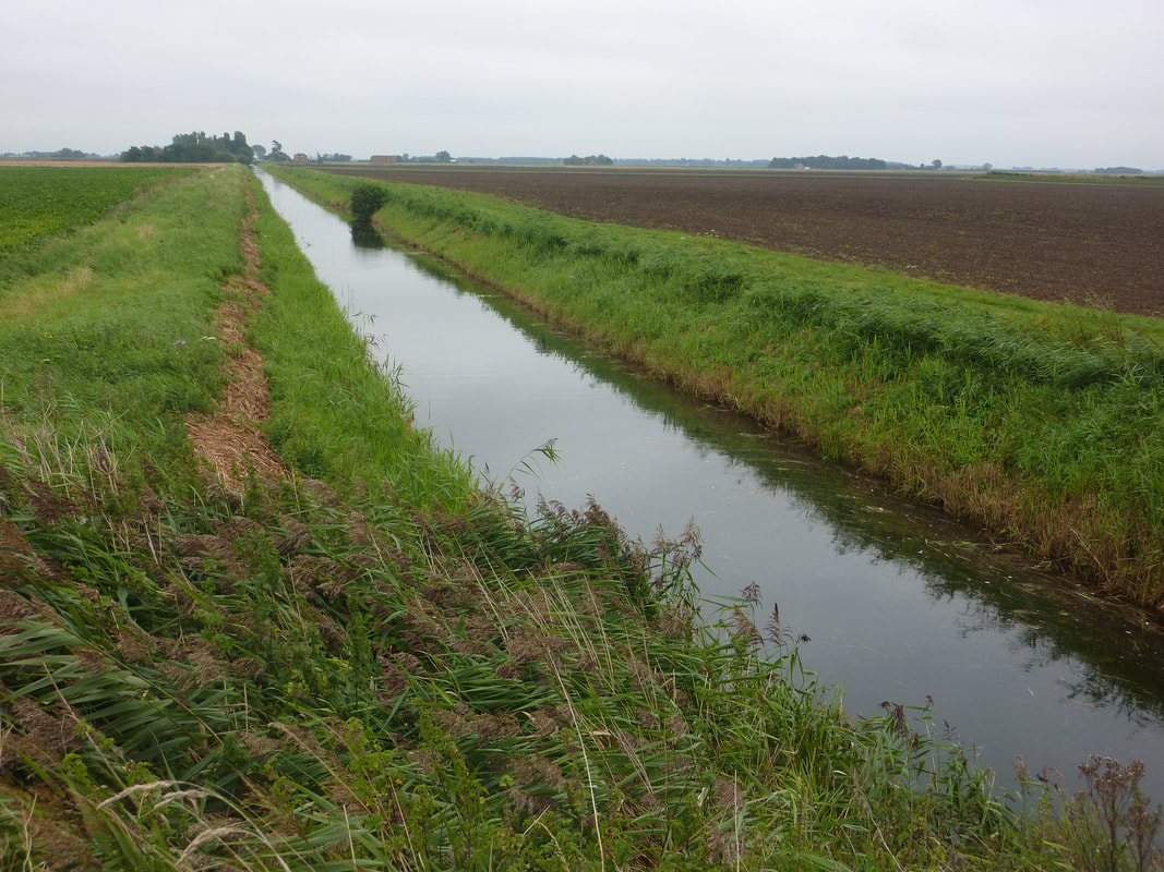
The Counties of Lincolnshire, Cambridgeshire, Norfolk, and in a minor way Suffolk all lay claim to a part of the Fens. Since Roman times mankind alone by his ingenuity, hard work, and determination has increased the landmass of the Fens by one third of the size they are today. It is the largest plain in the British Isles covering an area of nearly three-quarters of a million acres, which is roughly the size of the county of Surrey. The rivers running through the Fens have a catchment area from the surrounding high country five times the size of the Fens themselves making a total area of over 4 million acres to be drained. These rivers are all gravity fed through the Fens into the Wash and are almost all above the level of the land, some many feet higher. The fenland waters are pumped into the main drainage dykes and drains that traverse the Fens and from there they are pumped up into the rivers above or near the coast directly into the Wash itself. Many lowland lying areas are pumped twice and some three times before being discharged into rivers. The total pumping capacity of all the pumping stations in the Fens are capable of moving in the region of ten million gallons of water per minute when they are all in operation. Add this to the highland water passing through the Fens rivers from a catchment area five times as great, gives one some idea of the water that is discharged into the Wash at times of flood. This highlights the management and expertise needed to maintain the status quo created by runoff. For thousands of years this has happened but what has changed is, surface runoff, the time difference between the water being deposited on the soil, or man-made surface and passing into the drains and rivers, a man-made problem created by urbanisation and changing farming patterns.
Rex Sly in his book From Punt to Plough says: The Romans were attracted to the fens because of the fertile soil, the vast tracts of peat (especially in the East Fen) and fish, eels and waterfowl. Banks which had previously been presumed to be Roman are probably from Saxon or post conquest periods.
Dykes and banks served a double purpose, one taking upland water around the Fens into rivers for discharge into the sea and protection from sea water. Fendike Bank is shown on both Dugdale’s map of 1661/ 1664 and on William Stukeley’s map of 1723.
He describes fenland as “a country of space, a place where two thirds of your field of vision is the sky. For those who live and work in the Fens, the sky plays a great part in the landscape. There is no defining line between land and sky; they blend together to create a kingdom that is forever changing. Cumulus clouds resemble hills and mountain ranges in the distance tipped with peaks covered in snow and screed.”
However, East Fen today is unrecognisable from that which my ancestors inhabited up to the nineteenth century. As fen commoners in a sparsely populated landscape, they would have seen the wetland as a challenge but also as one that provided a living. Flooded in winter, the fen pasture would dry in summer and become good grazing and fodder for their livestock.
THE LANDSCAPE OF THE TOYNTON VILLAGES
The two villages of Toynton St Peter and Toynton All Saints had the advantage of being situated at the southern edge of the Lincolnshire Wolds (see MAP NO 3 in MAPS OF EAST FEN) a much drier and hospitable place in winter; livestock would be moved to this higher ground when the fen flooded. This map demonstrates the huge contrast between the landscape around the two villages and that of East Fen itself.
The enclosure maps in the section entitled ENCLOSURE OF THE TOYNTONS also show the thriving agricultural nature of the fields around the villages. It is also interesting to see that as that agricultural land meets the fen, there are what are called Ings, which is the lower lying marshland on the edge of the fen.
THE NORTHERN FEN EDGE
An archeological field survey was published by East Anglian Archaeology in 1993 called The Fenland Project Number 8: Lincolnshire Survey, the Northern Fen Edge.
The field survey was carried out by the author of the publication T. W. (Tom) Lane with a major contribution by Peter Hayes. This is a hugely thorough and well documented study and the fact that the two Toynton villages are central to the area under consideration is of enormous importance to my own researches. Most of the study does concentrate on ancient history with sections on the Mesolithic-Neolithic, early and middle Bronze Ages, Iron Age, Romano-British, Saxon, and Medieval finds. Here I can only summarise here what has been found.
At the risk of repeating what has already been stated, I have included the following extracts from the publication:
“The Fenland of Eastern England is an extensive tract of former wetland covering some 400,000 ha (Hall 1989, 15). It was created by the gradual infilling of a lowland basin with a succession of alluvial deposits. Subsequent drainage, particularly over the past three hundred years, has turned it into a highly fertile landscape ideal for intensive arable agriculture. It is a land that requires constant management of its many waterways, for it is still lowland, almost all below 3.5m OD and with large areas, particularly in Cambridgeshire, where the land surface lies below sea-level.
Only the relentless, ocean-like flatness and the extensive geometric pattern of drains, dykes and ditches point to a watery past: one characterised by extensive saltmarshes, pierced by winding tidal creeks, and boggy fens surrounding stagnant pools. For much of the past there existed a fine and shifting balance between landscape and seascape.
To either side lie East and West Fens, drained areas of former wetland that are, themselves, now strikingly dissimilar. A map of the region published by Dugdale
(1772) amply reflects the nature of East and West Fens in the seventeenth century. In contrast to the empty and unbroken aspect of West Fen the East Fen was dominated by a series of shallow lakes, called 'Deepes', the result of extracting large quantities of the once abundant peat (discussed more fully in Chapter 3). Although the deep peat, which had blanketed East Fen from the Bronze Age, has now largely wasted, the soils of East Fen are still organically rich, creating a distinctive 'black fen' in comparison to the brown and yellow silty clays which form the surface sediments west of the moraine.
An undulating ridge of partly drift-covered Cretaceous sandstone, frequently referred to as the southern extremity of the Lincolnshire W olds, forms the northern part of the fen-edge parishes. Towards the centre of this group of parishes the surface plunges steeply from c. 75m OD to c.15m OD from which level the land shelves more gradually beneath the fen deposits. The surface of the fen-edge area is characterised by glacial clays east of Stickford, and gravels to the west. Many of the villages along this edge are sited just away from the highest areas, overlooking the Fen.
THE DEEPS OF EAST FEN
The Ascoughs, living on the northern edge of the East Fen, might have been amazed if, as noted by H C Darby in his book The Changing Fenland, the Deeps of the East Fen were described as "particularly bad". They provided generations of fen commoners with a livelihood from catching fish and wildfowl and collecting peat, reeds and rushes for their cottages.
The Deeps (or “Deepes” as they were earlier called) of East Fen were the most prominent of the wetlands of South Lincolnshire. East Fen was an area of wetland, prone to flooding from the run off down the edge of the higher ground of the Wolds. This was fresh water that replenished large pools that had been created in medieval times by the extraction of the peat that was, a main feature of this particular fen. These pools were called “The Deeps”. The cutting and selling of peat seemed to have been a highly profitable industry. The Deeps were also a good source of fish: bream, pike, eels, roach and perch could be caught.
These “Deeps” and are shown on various maps included in R C Wheeler’s Maps of the Witham Fens. The first is one from after 1585, then Wenceslas Hollar’s map of 1661, William Stukeley’s map of 1723, I Grundy’s map of 1774 and finally an enclosure map of 1778/9 (the date according to R C Wheeler) but may be 1820.
J S Padley in his 1882 book The Fens and Floods of Mid-Lincolnshire records the names of the sixty-one pools. They gradually reduced in size and number during the drainage schemes of the late eighteenth and nineteenth centuries.
The pools were connected by “Havens”, “Rows” or “Boating’s” and it was a pleasant excursion in the summer to row from pool to pool the entire length to Wainfleet. They also enabled the transport of goods including livestock, to the harbour there.
The centre of each pool was free from weeds and although the bottom was mud, perhaps three feet deep, above was three to four feet of amazingly clear water. It was therefore easy to see and catch fish with a net or even a hay-fork.
Padley explains:
The margins of both pools and rows were shaded by a thick border of reeds, generally from seven to eight feet in height. A peculiar feature in this Pen was the “hassock." The eddying of the currents formed numberless little columns of earthy matter, which by continual accretion acquired a certain amount of solidity ; when the head of the column once reached the surface, it was speedily covered with vegetation, the down-shooting roots of which supplied an additional element of elastic cohesion. An active person could step from one of these hassocks to another for a considerable distance, but, as they swayed to and fro, an amount of caution was necessary to escape a floundering.
In the summer season, when the water had drained off or been evaporated, the surface of large districts was exposed, which speedily bore a strong crop of coarse grass, called " fodder." Every persons having a right in this Fen, had the privilege of employing two labourers, and with them would go down into the Fen on the evening before Midsummerday, and lie down until they heard the report of a gun which was fired exactly at twelve o'clock (midnight) ; then each party would arise and set to work. By common agreement, all the “fodder” they could mow a path around became the frontager's own property.
After completing one circle, each party hastened to find fresh - ground to encircle in like manner, as long as any remained unclaimed, after which they completed at leisure the mowing of those parts they had surrounded. When the reaping was over, the "fodder" was gathered up, and boated away by the different rows to the fenside, from whence it was carted to their homes.
This unwritten law was rigidly observed, one of them accidentally trenched upon another's " balk," he immediately withdrew; a narrow row of grass was usually left standing to mark the boundary of each person's temporary property.
Usually, too, each frontager secured a sufficiently large stack to serve his cows and other cattle through the winter.
Much fuel was collected from this Fen, but it was obtained in a different state to that
raised in the other Fens, being dug in large squares out of a solid peat, in a similar manner to that in which peat is gathered in Ireland; when ready for use it formed a splendid fuel.
In addition to the deeps and rows which remained in the summer, the whole Fen was
covered by water in the winter, partly owing to the reception of a stream of water by the brook from the two Toyntons, and still more perhaps owing to the neglect of the White Cross Sluice, by which, as will be seen on reference to Grundy's 1774 Report, more water escaped from the Steeping River into the Fen than went down the Wainfleet Haven.
The birds of this Fen, in addition to ducks and geese, were the bustard and the bittern.
Padley’s description of the creation of The Deeps is noted in Fenland Project Number 8:
J S Padley’s “The Fens and Floods of Mid-Lincolnshire” published in 1882 described peat extraction in East Fen: “Much peat was collected from this (East) Fen, but it was obtained in a different state to that raised in other Fens, being dug in large squares out of solid peat, in a similar manner to that in which peat is gathered in Ireland”.
In addition to domestic uses, the peat fuelled two medieval industries, salt processing and pottery manufacture. The former took place exclusively on the coast. Pottery was manufactured on the adjacent uplands, notably at Toynton All Saints, but also elsewhere along the ridge to Bolingbroke. For a time, Toynton All Saints acquired the name Potter Toynton. In addition to many previously known pottery sites, kilns or their waste were found extensively in the Toyntons and the Keals. It was also suggested that 'the potters were often also farmers of smallholdings' but despite this, their wares dominated the local markets in the Middle Ages and travelled throughout the county and beyond. However, the lack of fine pottery on the northern fen-edge genuinely reflects the relative poverty of the inhabitants.
Today we can still see the blackland of East Fen, an organic blanket that continues to suffer the deleterious effects of drainage. Another source is quoted: “The subsidence of the upper stratum of peat in East Fen has caused the surface to be full two feet six inches lower than at Enclosure” When he observed that “labourers used to dig through peat as high as their shoulders before they found clay - the peat stratum now scarcely reaches their knees”.
In addition to the fen, the dryland archaeology has important landscape divisions; uphill and downhill. The former, an undulating plateau of light sandy soils, attracted the Mesolithic communities and subsequently proved ideal for primitive agriculture. Traditionally it has provided the bread whilst downhill, the grassland, meadows and fens have fattened the beef.
PEAT WORKING IN FENLAND
I D Rotherham in his book The Lost Fens spends much time discussing the methods of cutting turves and peat. Not easy work. The best peat is at deeper levels, well decomposed and heavily compacted. Great for fuel. He continues:
One obvious problem that was not understood by the early drainers until rather late, was that if you actually mange to drain a peat bog or fen, it dries and shrinks. This means that very quickly your site is lower than the surrounding land and, of course, water will flow back in. The only solution is active pumping to a drain that is markedly higher than your original ground. To do this requires pumps, originally wind or animal powered, then steam, petrol or diesel and then electric.
(Drive through the Cambridgeshire and Lincolnshire fens today you will see how the drains and often the roads are higher than the surrounding landscapes.)
Ethel Rudkin in her Notes on the History of Toynton All Saints and Toynton St Peter says:
Before the enclosure of these fens, in 1810, there were stagnant pools of water dispersed over the boggy ground that lay to the west of the old shore line.
These pools were probably first formed by digging for peat, or even the clay under the peat, for clay was used extensively for a number of purposes – in making houses of mud and stud, for making earthen floors and for making pottery.
Ethel Rudkin mentions clay under the peat for the mud and stud houses. And for the pottery kilns. (W H Wheeler’s Diagram showing the strata reveals alluvium below the peat “varies from light silty soil to STIFF CLAY”). It also shows the boulder clay ridge (Fenland Project No 8 calls it “the Stickney moraine”) north and south from Stickney which divides the West and East Fens). Also see the Lidar image.
Professor I G Simmons in his superb publication Margins of the East Fen: Historic Landscape Evolution says it all:
But nowhere in the manuscript historical documentation of the East Fen is there a mention of ‘The Deeps’, areas of shallow but open water with irregular outlines and which featured in many maps of the Fen until the final nineteenth century drainage. So, there is no evidence for their origin or use, only for their disappearance. The first attempts at large-scale reclamation of the East Fen in the seventeenth century were to have left the Deeps more or less untouched but by the time of the general enclosure they were much reduced and regularised, and then the final draining left them dried out and indistinguishable from the rest of the now agricultural fen. Notably, none of the present-day images such as LIDAR or satellite imagery outlines their distribution at all. However, if an up-to-date map of areas below sea-level is obtained then it looks as if the former Deeps roughly coincide with the areas of greatest shrinkage of the fen since drainage though less so with the Friskney-centred area of postulated former raised bog. The section through ‘Long Water’ and ‘Silver Pit’ on Bower’s section along the Hobhole Drain confirms the topology of these depressions to be like those of the Norfolk Broads and that the Deeps of the East Fen were almost certainly peat cuttings which became drowned at a time of rising sea-level. There is little direct evidence of when this took place though an Inquest of 1318 which was anxious about the ‘fluxes and reflexes of the sea’ in exacerbating the poor drainage of the East Fen via Wainfleet Haven mentioned the likely damage if the causeway was not kept in good order.
And if the said causeway should be broken and open at all times of the year then the said marsh and also the lands and tenements, meadows, common pastures and fisheries and diggings of peat around the said marsh in the low places adjacent to the marsh, and also the common pastures and fisheries and diggings in the said marsh will be finally destroyed and consumed by the fluxes and refluxes of the sea at all times of the year.
In the absence of better evidence, the earlier part of the fourteenth century seems to be the most likely time, as it was in Norfolk; the one literary reference to a Deep comes from 1374 - 1375 when a miracle happened to Simon Broun of Wainfleet sailing a small boat on Rabwater. A sudden storm threw him out but by the intervention of St Edmund (whose chapel in Wainfleet was at that time roofless) he was restored.
Professor Simmons quotes a twelfth-century commentator from Peterborough, Hugh Candidus:
[The fen] is very valuable to men, because there are obtained in abundance all things needful for them that dwell nearby, logs and stubble for kindling, hay for the feeding of their beasts, thatch for the roofing of their houses, and many other things of use and profit, and moreover it is very full of fish and fowl. There are divers rivers and many other waters there, and moreover great fishponds. In all these things the district is very rich.
Since the East Fen has been bounded by banks on the east and south sides for many centuries, it is interesting to know what the extent of peat fen was before it was subject to more than minimal human activity.
HISTORY OF THE EAST FEN LANDSCAPE
Camden’s history in 1602 sets out the state of the fens:
The East Fen is quite in a state of nature, and exhibits a specimen of
what the country was before the introduction of draining. It is a
vast tract of morass, intermixed with numbers of lakes, from half a
mile to two or three miles in circuit, communicating with each other
by narrow reedy straits. They are very shallow, none above four
or five feet deep, but abound with pike, perch, ruffs, bream, tench,
dace, eels, &c. The reeds which cover the fens are cut annually
for thatching not only cottages, but many very good houses. The
multitudes of stares that roost in these weeds in winter break down
many by perching on them. A stock of reeds well harvested and
stacked is worth two or three hundred pounds. The birds which
inhabit the different fens are very numerous. Besides the common
wild duck; wild geese, garganies, pochards, shovellers, and teals
breed here, pewit, gulls, and black terns abound: a few of the great
terns or tickets are seen among them. The great crested grebes,
called gaunts, are found in the East Fen. The lesser crested, the
black and dusky, and the little grebe, cootes, water hens and spotted
water-hens, water-rails, ruffs, red-shanks, lapwings or wypes, redbreasted
godwits and whimbrels are inhabitants of these fens. The
godwits breed near Washingborough, three miles east of Lincoln;
the whimbrels only appear for a fortnight in May and then quit the
country."
MODERN DAY FENLAND
THE LINCOLNSHIRE FENS
The Fens, that great chunk of eastern England extending from Boston in Lincolnshire right down to Cambridge, encompass some of the most productive farmland in Europe. Give or take the occasional hillock, this pancake-flat, treeless terrain has been painstakingly reclaimed from the marshes and swamps which once drained into the intrusive stump of The Wash, a process that has taken almost two thousand years Nonetheless, the Lincolnshire Fens remain a distinctive area, with a scattering of introverted little villages spread across the flatlands.
R C Wheeler in his Maps of the Witham Fens tells us: East of the West Fen, Stickney and Sibsey occupy a tongue (or strip north to south) of high land, and then comes the East Fen, a wild expanse devoid of settlement but with a great many “deeps”, permanent bodies of water created by peat digging (extraction), Lincolnshire’s lost version of the Norfolk Broads. Originally the East Fen drained to the east to Wainfleet Haven.
It hardly drained at all, but the roddons, the dried raised bed of a watercourse (such as a river or tidal-creek) shown on the Lidar that follows, do drain west to east.
S J (Steve) Malone in his publication Lincolnshire Fenland Lidar (Heritage Trust of Lincolnshire / Archaeological Project Services) describes Airborne Laser Altimetry or Lidar (Light Detection and Ranging) using laser light and GPS to produce horizontal and vertical accurate elevation measurements over a wide area. Aircraft and satellites are used for surveys. Steve Malone’s paper is freely available on the net and is extremely technical.
He explains:
The Drainage pattern within the Witham Valley provides an exemplar of that seen in the wider fenland. The silt filled former water courses (roddons) stand higher than the surrounding ground and the Lidar survey picks up the subtle changes in elevation of this peculiar inverted relief. The formation mechanism of the roddons remains imperfectly understood but they show particularly clearly in areas of former peat fen where the drainage and desiccation has reduced ground levels (many of these areas now being at or below sea level) and shown as very pale or white shades in the overall plot).
The fine resolution of the roddon systems seen even with a 2m centred lidar is demonstrated well in East Fen, north east of Boston. Here an east-west system can be seen draining towards the coast at Wainfleet (and disappearing under later marine silts.) A later north-south system overlies this draining the southern edge of the fen towards Wrangle (Fig 7).
Joan Thirsk, in her book English Peasant Farming describes the landscape in the sixteenth century.
The most favoured region from the farming point of view was undoubtedly the southern end of the Wolds, deep and fertile loams merging into fenny ground.
In the extreme south where the Wolds dip gently into the fen, much of the chalk has been washed from the hillsides, bringing the underlying clay and Spilsby sandstone to the surface. This southern part of the Wolds is a gently undulating country, as sheltered and inviting to the present-day traveller as it was to the early settlers. It was densely settled by the Danes, and, on the Domesday map, appears as the most populous area of Lincolnshire. Although by the mid sixteenth century other regions of the marsh and fen competed with it, it remained extremely thickly settled.
Hitherto the inhabitants of the southern Wold villages had enjoyed unstinted common in East, West and Wildmore Fens, which lay like a broad carpet to the south of their parishes. Lands within the parish lay for the most part to tillage divided between two fields which were cropped in alternate years. It was the custom of these villages to depend on the fen for most of their summer pasturage, keeping the grasslands at home to provide hay against the winter.
THE LANDSCAPE OF EAST FEN
This area of fenland, most of it at about sea level, is bounded to the south west by the River Witham and to the south east by a low silt ridge of marine origin which separates it from The Wash. The northern boundary is defined by the Lincolnshire Wolds to the north, and Wainfleet and the Steeping River to the north east. East Fen is separated from West Fen by a strip of higher ground, some 7 miles (11 km) long and 0.5 miles (0.8 km) wide, on which are situated the villages of Stickford, Stickney and Sibsey. The A16 road now follows this higher ground which is glacial in origin. Historically, the south-western section of the West Fen close to the River Witham was called the Wildmore Fen, but hydraulically, they form a single fen.
At least until the eighteenth century the East Fen acted as an unpredictable store of water that might flood much of the Low Grounds; the Wolds to the north contributed much of that water as it ran down from that higher land.
In the introduction to his article In the Fens, Rex Sly perfectly describes the landscape of the Fens:
The Counties of Lincolnshire, Cambridgeshire, Norfolk, and in a minor way Suffolk all lay claim to a part of the Fens. Since Roman times mankind alone by his ingenuity, hard work, and determination has increased the landmass of the Fens by one third of the size they are today. It is the largest plain in the British Isles covering an area of nearly three-quarters of a million acres, which is roughly the size of the county of Surrey. The rivers running through the Fens have a catchment area from the surrounding high country five times the size of the Fens themselves making a total area of over 4 million acres to be drained. These rivers are all gravity fed through the Fens into the Wash and are almost all above the level of the land, some many feet higher. The fenland waters are pumped into the main drainage dykes and drains that traverse the Fens and from there they are pumped up into the rivers above or near the coast directly into the Wash itself. Many lowland lying areas are pumped twice and some three times before being discharged into rivers. The total pumping capacity of all the pumping stations in the Fens are capable of moving in the region of ten million gallons of water per minute when they are all in operation. Add this to the highland water passing through the Fens rivers from a catchment area five times as great, gives one some idea of the water that is discharged into the Wash at times of flood. This highlights the management and expertise needed to maintain the status quo created by runoff. For thousands of years this has happened but what has changed is, surface runoff, the time difference between the water being deposited on the soil, or man-made surface and passing into the drains and rivers, a man-made problem created by urbanisation and changing farming patterns.
Rex Sly in his book From Punt to Plough says: The Romans were attracted to the fens because of the fertile soil, the vast tracts of peat (especially in the East Fen) and fish, eels and waterfowl. Banks which had previously been presumed to be Roman are probably from Saxon or post conquest periods.
Dykes and banks served a double purpose, one taking upland water around the Fens into rivers for discharge into the sea and protection from sea water. Fendike Bank is shown on both Dugdale’s map of 1661/ 1664 and on William Stukeley’s map of 1723.
He describes fenland as “a country of space, a place where two thirds of your field of vision is the sky. For those who live and work in the Fens, the sky plays a great part in the landscape. There is no defining line between land and sky; they blend together to create a kingdom that is forever changing. Cumulus clouds resemble hills and mountain ranges in the distance tipped with peaks covered in snow and screed.”
However, East Fen today is unrecognisable from that which my ancestors inhabited up to the nineteenth century. As fen commoners in a sparsely populated landscape, they would have seen the wetland as a challenge but also as one that provided a living. Flooded in winter, the fen pasture would dry in summer and become good grazing and fodder for their livestock.
THE LANDSCAPE OF THE TOYNTON VILLAGES
The two villages of Toynton St Peter and Toynton All Saints had the advantage of being situated at the southern edge of the Lincolnshire Wolds (see MAP NO 3 in MAPS OF EAST FEN) a much drier and hospitable place in winter; livestock would be moved to this higher ground when the fen flooded. This map demonstrates the huge contrast between the landscape around the two villages and that of East Fen itself.
The enclosure maps in the section entitled ENCLOSURE OF THE TOYNTONS also show the thriving agricultural nature of the fields around the villages. It is also interesting to see that as that agricultural land meets the fen, there are what are called Ings, which is the lower lying marshland on the edge of the fen.
THE NORTHERN FEN EDGE
An archeological field survey was published by East Anglian Archaeology in 1993 called The Fenland Project Number 8: Lincolnshire Survey, the Northern Fen Edge.
The field survey was carried out by the author of the publication T. W. (Tom) Lane with a major contribution by Peter Hayes. This is a hugely thorough and well documented study and the fact that the two Toynton villages are central to the area under consideration is of enormous importance to my own researches. Most of the study does concentrate on ancient history with sections on the Mesolithic-Neolithic, early and middle Bronze Ages, Iron Age, Romano-British, Saxon, and Medieval finds. Here I can only summarise here what has been found.
At the risk of repeating what has already been stated, I have included the following extracts from the publication:
“The Fenland of Eastern England is an extensive tract of former wetland covering some 400,000 ha (Hall 1989, 15). It was created by the gradual infilling of a lowland basin with a succession of alluvial deposits. Subsequent drainage, particularly over the past three hundred years, has turned it into a highly fertile landscape ideal for intensive arable agriculture. It is a land that requires constant management of its many waterways, for it is still lowland, almost all below 3.5m OD and with large areas, particularly in Cambridgeshire, where the land surface lies below sea-level.
Only the relentless, ocean-like flatness and the extensive geometric pattern of drains, dykes and ditches point to a watery past: one characterised by extensive saltmarshes, pierced by winding tidal creeks, and boggy fens surrounding stagnant pools. For much of the past there existed a fine and shifting balance between landscape and seascape.
To either side lie East and West Fens, drained areas of former wetland that are, themselves, now strikingly dissimilar. A map of the region published by Dugdale
(1772) amply reflects the nature of East and West Fens in the seventeenth century. In contrast to the empty and unbroken aspect of West Fen the East Fen was dominated by a series of shallow lakes, called 'Deepes', the result of extracting large quantities of the once abundant peat (discussed more fully in Chapter 3). Although the deep peat, which had blanketed East Fen from the Bronze Age, has now largely wasted, the soils of East Fen are still organically rich, creating a distinctive 'black fen' in comparison to the brown and yellow silty clays which form the surface sediments west of the moraine.
An undulating ridge of partly drift-covered Cretaceous sandstone, frequently referred to as the southern extremity of the Lincolnshire W olds, forms the northern part of the fen-edge parishes. Towards the centre of this group of parishes the surface plunges steeply from c. 75m OD to c.15m OD from which level the land shelves more gradually beneath the fen deposits. The surface of the fen-edge area is characterised by glacial clays east of Stickford, and gravels to the west. Many of the villages along this edge are sited just away from the highest areas, overlooking the Fen.
THE DEEPS OF EAST FEN
The Ascoughs, living on the northern edge of the East Fen, might have been amazed if, as noted by H C Darby in his book The Changing Fenland, the Deeps of the East Fen were described as "particularly bad". They provided generations of fen commoners with a livelihood from catching fish and wildfowl and collecting peat, reeds and rushes for their cottages.
The Deeps (or “Deepes” as they were earlier called) of East Fen were the most prominent of the wetlands of South Lincolnshire. East Fen was an area of wetland, prone to flooding from the run off down the edge of the higher ground of the Wolds. This was fresh water that replenished large pools that had been created in medieval times by the extraction of the peat that was, a main feature of this particular fen. These pools were called “The Deeps”. The cutting and selling of peat seemed to have been a highly profitable industry. The Deeps were also a good source of fish: bream, pike, eels, roach and perch could be caught.
These “Deeps” and are shown on various maps included in R C Wheeler’s Maps of the Witham Fens. The first is one from after 1585, then Wenceslas Hollar’s map of 1661, William Stukeley’s map of 1723, I Grundy’s map of 1774 and finally an enclosure map of 1778/9 (the date according to R C Wheeler) but may be 1820.
J S Padley in his 1882 book The Fens and Floods of Mid-Lincolnshire records the names of the sixty-one pools. They gradually reduced in size and number during the drainage schemes of the late eighteenth and nineteenth centuries.
The pools were connected by “Havens”, “Rows” or “Boating’s” and it was a pleasant excursion in the summer to row from pool to pool the entire length to Wainfleet. They also enabled the transport of goods including livestock, to the harbour there.
The centre of each pool was free from weeds and although the bottom was mud, perhaps three feet deep, above was three to four feet of amazingly clear water. It was therefore easy to see and catch fish with a net or even a hay-fork.
Padley explains:
The margins of both pools and rows were shaded by a thick border of reeds, generally from seven to eight feet in height. A peculiar feature in this Pen was the “hassock." The eddying of the currents formed numberless little columns of earthy matter, which by continual accretion acquired a certain amount of solidity ; when the head of the column once reached the surface, it was speedily covered with vegetation, the down-shooting roots of which supplied an additional element of elastic cohesion. An active person could step from one of these hassocks to another for a considerable distance, but, as they swayed to and fro, an amount of caution was necessary to escape a floundering.
In the summer season, when the water had drained off or been evaporated, the surface of large districts was exposed, which speedily bore a strong crop of coarse grass, called " fodder." Every persons having a right in this Fen, had the privilege of employing two labourers, and with them would go down into the Fen on the evening before Midsummerday, and lie down until they heard the report of a gun which was fired exactly at twelve o'clock (midnight) ; then each party would arise and set to work. By common agreement, all the “fodder” they could mow a path around became the frontager's own property.
After completing one circle, each party hastened to find fresh - ground to encircle in like manner, as long as any remained unclaimed, after which they completed at leisure the mowing of those parts they had surrounded. When the reaping was over, the "fodder" was gathered up, and boated away by the different rows to the fenside, from whence it was carted to their homes.
This unwritten law was rigidly observed, one of them accidentally trenched upon another's " balk," he immediately withdrew; a narrow row of grass was usually left standing to mark the boundary of each person's temporary property.
Usually, too, each frontager secured a sufficiently large stack to serve his cows and other cattle through the winter.
Much fuel was collected from this Fen, but it was obtained in a different state to that
raised in the other Fens, being dug in large squares out of a solid peat, in a similar manner to that in which peat is gathered in Ireland; when ready for use it formed a splendid fuel.
In addition to the deeps and rows which remained in the summer, the whole Fen was
covered by water in the winter, partly owing to the reception of a stream of water by the brook from the two Toyntons, and still more perhaps owing to the neglect of the White Cross Sluice, by which, as will be seen on reference to Grundy's 1774 Report, more water escaped from the Steeping River into the Fen than went down the Wainfleet Haven.
The birds of this Fen, in addition to ducks and geese, were the bustard and the bittern.
Padley’s description of the creation of The Deeps is noted in Fenland Project Number 8:
J S Padley’s “The Fens and Floods of Mid-Lincolnshire” published in 1882 described peat extraction in East Fen: “Much peat was collected from this (East) Fen, but it was obtained in a different state to that raised in other Fens, being dug in large squares out of solid peat, in a similar manner to that in which peat is gathered in Ireland”.
In addition to domestic uses, the peat fuelled two medieval industries, salt processing and pottery manufacture. The former took place exclusively on the coast. Pottery was manufactured on the adjacent uplands, notably at Toynton All Saints, but also elsewhere along the ridge to Bolingbroke. For a time, Toynton All Saints acquired the name Potter Toynton. In addition to many previously known pottery sites, kilns or their waste were found extensively in the Toyntons and the Keals. It was also suggested that 'the potters were often also farmers of smallholdings' but despite this, their wares dominated the local markets in the Middle Ages and travelled throughout the county and beyond. However, the lack of fine pottery on the northern fen-edge genuinely reflects the relative poverty of the inhabitants.
Today we can still see the blackland of East Fen, an organic blanket that continues to suffer the deleterious effects of drainage. Another source is quoted: “The subsidence of the upper stratum of peat in East Fen has caused the surface to be full two feet six inches lower than at Enclosure” When he observed that “labourers used to dig through peat as high as their shoulders before they found clay - the peat stratum now scarcely reaches their knees”.
In addition to the fen, the dryland archaeology has important landscape divisions; uphill and downhill. The former, an undulating plateau of light sandy soils, attracted the Mesolithic communities and subsequently proved ideal for primitive agriculture. Traditionally it has provided the bread whilst downhill, the grassland, meadows and fens have fattened the beef.
PEAT WORKING IN FENLAND
I D Rotherham in his book The Lost Fens spends much time discussing the methods of cutting turves and peat. Not easy work. The best peat is at deeper levels, well decomposed and heavily compacted. Great for fuel. He continues:
One obvious problem that was not understood by the early drainers until rather late, was that if you actually mange to drain a peat bog or fen, it dries and shrinks. This means that very quickly your site is lower than the surrounding land and, of course, water will flow back in. The only solution is active pumping to a drain that is markedly higher than your original ground. To do this requires pumps, originally wind or animal powered, then steam, petrol or diesel and then electric.
(Drive through the Cambridgeshire and Lincolnshire fens today you will see how the drains and often the roads are higher than the surrounding landscapes.)
Ethel Rudkin in her Notes on the History of Toynton All Saints and Toynton St Peter says:
Before the enclosure of these fens, in 1810, there were stagnant pools of water dispersed over the boggy ground that lay to the west of the old shore line.
These pools were probably first formed by digging for peat, or even the clay under the peat, for clay was used extensively for a number of purposes – in making houses of mud and stud, for making earthen floors and for making pottery.
Ethel Rudkin mentions clay under the peat for the mud and stud houses. And for the pottery kilns. (W H Wheeler’s Diagram showing the strata reveals alluvium below the peat “varies from light silty soil to STIFF CLAY”). It also shows the boulder clay ridge (Fenland Project No 8 calls it “the Stickney moraine”) north and south from Stickney which divides the West and East Fens). Also see the Lidar image.
Professor I G Simmons in his superb publication Margins of the East Fen: Historic Landscape Evolution says it all:
But nowhere in the manuscript historical documentation of the East Fen is there a mention of ‘The Deeps’, areas of shallow but open water with irregular outlines and which featured in many maps of the Fen until the final nineteenth century drainage. So, there is no evidence for their origin or use, only for their disappearance. The first attempts at large-scale reclamation of the East Fen in the seventeenth century were to have left the Deeps more or less untouched but by the time of the general enclosure they were much reduced and regularised, and then the final draining left them dried out and indistinguishable from the rest of the now agricultural fen. Notably, none of the present-day images such as LIDAR or satellite imagery outlines their distribution at all. However, if an up-to-date map of areas below sea-level is obtained then it looks as if the former Deeps roughly coincide with the areas of greatest shrinkage of the fen since drainage though less so with the Friskney-centred area of postulated former raised bog. The section through ‘Long Water’ and ‘Silver Pit’ on Bower’s section along the Hobhole Drain confirms the topology of these depressions to be like those of the Norfolk Broads and that the Deeps of the East Fen were almost certainly peat cuttings which became drowned at a time of rising sea-level. There is little direct evidence of when this took place though an Inquest of 1318 which was anxious about the ‘fluxes and reflexes of the sea’ in exacerbating the poor drainage of the East Fen via Wainfleet Haven mentioned the likely damage if the causeway was not kept in good order.
And if the said causeway should be broken and open at all times of the year then the said marsh and also the lands and tenements, meadows, common pastures and fisheries and diggings of peat around the said marsh in the low places adjacent to the marsh, and also the common pastures and fisheries and diggings in the said marsh will be finally destroyed and consumed by the fluxes and refluxes of the sea at all times of the year.
In the absence of better evidence, the earlier part of the fourteenth century seems to be the most likely time, as it was in Norfolk; the one literary reference to a Deep comes from 1374 - 1375 when a miracle happened to Simon Broun of Wainfleet sailing a small boat on Rabwater. A sudden storm threw him out but by the intervention of St Edmund (whose chapel in Wainfleet was at that time roofless) he was restored.
Professor Simmons quotes a twelfth-century commentator from Peterborough, Hugh Candidus:
[The fen] is very valuable to men, because there are obtained in abundance all things needful for them that dwell nearby, logs and stubble for kindling, hay for the feeding of their beasts, thatch for the roofing of their houses, and many other things of use and profit, and moreover it is very full of fish and fowl. There are divers rivers and many other waters there, and moreover great fishponds. In all these things the district is very rich.
Since the East Fen has been bounded by banks on the east and south sides for many centuries, it is interesting to know what the extent of peat fen was before it was subject to more than minimal human activity.
HISTORY OF THE EAST FEN LANDSCAPE
Camden’s history in 1602 sets out the state of the fens:
The East Fen is quite in a state of nature, and exhibits a specimen of
what the country was before the introduction of draining. It is a
vast tract of morass, intermixed with numbers of lakes, from half a
mile to two or three miles in circuit, communicating with each other
by narrow reedy straits. They are very shallow, none above four
or five feet deep, but abound with pike, perch, ruffs, bream, tench,
dace, eels, &c. The reeds which cover the fens are cut annually
for thatching not only cottages, but many very good houses. The
multitudes of stares that roost in these weeds in winter break down
many by perching on them. A stock of reeds well harvested and
stacked is worth two or three hundred pounds. The birds which
inhabit the different fens are very numerous. Besides the common
wild duck; wild geese, garganies, pochards, shovellers, and teals
breed here, pewit, gulls, and black terns abound: a few of the great
terns or tickets are seen among them. The great crested grebes,
called gaunts, are found in the East Fen. The lesser crested, the
black and dusky, and the little grebe, cootes, water hens and spotted
water-hens, water-rails, ruffs, red-shanks, lapwings or wypes, redbreasted
godwits and whimbrels are inhabitants of these fens. The
godwits breed near Washingborough, three miles east of Lincoln;
the whimbrels only appear for a fortnight in May and then quit the
country."
MODERN DAY FENLAND
Fenland, as we know it today, is a vast, flat expanse of rich farmland interspersed with the network of drains unchanged since the early part of the nineteenth century. It provides a large proportion of the country’s agricultural produce.