THE NINETEENTH CENTURY
THE ASCOUGHS
At the beginning of the nineteenth century, John Ascough was 41 years old and his son John was 18. Before the elder John died in 1844, they were to see their lives turned upside down as a result of the drainage and enclosure of East Fen. Their lives as Fen Commoners became a thing of the past. The younger John’s son James was born in 1808 and by the 1851 Census he was employed as an Agricultural Labourer, probably working on the newly enclosed fens. This is how it happened.
THE CONDITION OF EAST FEN
When the nineteenth century opened, the condition of East Fen (which lay on a tract of peat) was particularly bad. In winter it was a mass of lakes (called The Deeps) which were bordered by a thick crop of reeds; and even in dry summers, The Deeps were covered by an average about two feet of water.
THE RENNIE REPORTS FOR THE DRAINAGE OF WEST, WILDMORE AND EAST FENS
Sir John Rennie had been asked to report upon the possibilities of draining the area and he published two reports in April and September of 1800. Their reception was by no means unanimous. There were conflicting views about the method of draining, and there were disputes about the suggested allotment of the drained fen.
In the section called MAPS OF EAST FEN is MAP NO 10. This is R C Wheeler’s Map No 59 (ii) in his book Maps of the Witham Fens, and titled “A Sketch of Wildmore Fen, West Fen and East Fen with the Marshes and Highlands adjacent in the County of Lincoln”. It is the map included in Rennie’s Report “concerning the Drainage of Wildmore Fen, and the East and West Fens” dated 7 April 1800. It shows proposals for new drains including, for the first time, THE EAST FEN CATCHWATER DRAIN, running westwards from a north easterly point of East Fen before turning south to head towards Boston). It also shows a drain going east to west through the centre of The Deeps, however this was later changed to north/south with the introduction of the HOBHOLE DRAIN.
Rennie’s ideas appear to be only partly developed at this stage: for example, the Hobhole Drain is shown, but the arrangements by which it was to collect the East Fen waters was very rudimentary. The scheme that was finally adopted does not appear on maps until:
MAP NO 11 (R C Wheeler’s Map Number 94.i) is a “Plan of intended lines of Navigation …… through the East, West and Wildmore Fens etc” by A Bower dated 1811.
MAP NO 15 (RC Wheeler’s Map No 202. It is entitled “EAST FEN: PLAN AFTER THE INCLOSURE 1810”. Showing the ancient deeps and the Rows, or Boatings thereto also the Hobhole Drain and new roads laid out at that time”.
This map appears in J S Padley’s book The Fens and Floods of Mid Lincolnshire. R C Wheeler describes it as follows: An early retrospective map of East Fen showing the old Deeps superimposed on the later pattern of drains. The Surveyor, J S Padley (1791-1881) was brought up on the West Fen and would have seen the drainage and enclosure of the three fens. He made this retrospective map at the end of his life so should be treated with caution. But a good source of bringing the old and new together.
THE COMMONER’S OBJECTIONS TO THE DRAINAGE OF THE FENS
Objections to the plans for the drainage and enclosure of the fens continued. Part of the reason for the long delay in enclosure was that local villages all held right of common there.
In 1800, there is recorded what is called a “Remonstrance” by a Holland Watchman “Against the Postscript to the Report of Mr John Rennie, Civil Engineer, concerning the Drainage of the East, West and Wildmore Fens in the County of Lincoln”
He states: Whether it be practical to drain the East Fen and the East Holland Towns, which are together more than 30,000 acres, by way of Maud Foster drain? In proving this scheme to be impractical, I shall present my evidence purely on Mr Rennie’s Report.
On considering the subject of the East Fen drainage, I think if the pits (the Deeps) are entirely given up, and suffered to remain covered in water; the other parts might be tolerably drained by way of Maud Foster.
Men of the East Fen and East Holland. Does he say that the East Fen will be as well drained as West and Wildmore Fens? No!
It appears evident to me that no good drainage from the East Fen through Maud Foster.
I find I must not speak of East Fen and Maud Foster. You shall, all of you, drain there or be drowned, and be drowned if you do drain there (Maud Foster Gout). But for your comfort, give up only the East Fen Deeps (that is 3,000 acres) to wild fowl for the London market, to fish for the Boston market, to reed for your houses, which will be covered with tiles or slate, and to bumbles for your chairs, which will be made of horse hair and mahogany, and then, as I expect certain things, which I cannot promise, and can give no reason, I think it is probable that you may be drained tolerably.
But for your comfort give up only the East Fen Deeps (that is 3,000 acres) to wild fowl for the London market; to fish for the Boston market; to reeds for your houses, which will be covered with tiles or slate; and to bumbles for your chairs which (like those of other good farmers) will be made of horsehair and mahogany; and then you may be drained tolerably. The question is not whether a few acres of the deepest pits (to which I see no objection) but whether three thousand acres shall be left under water just at your door.
Far too late came AN ADDRESS TO THE NINETY COMMONERS Having Rights on East, West and Wildmore Fens who signed an ineffectual requisition to Sir Joseph Banks to Call a General Meeting of the Commoners in the Soke of Bolinbroke.
By the Reverend Edward Walls 1807.
When we signed a Requisition to the Right Honourable Sir Joseph Banks to call a General Meeting of the Fen proprietors, we did not suppose that so fair a request would be denied.
The manifest partiality of having all the meetings in Boston is too unreasonable. For there are only eight towns in East Holland, which have a right of common in these fens, and there are twenty-two towns in the Soke of Bolinbroke.
I therefore wrote the following letter to Mr Tunnard:
“To you, our solicitor and advocate. I last night received from you, Sir Joseph Bank’s reasons for not calling the meeting of the Commoners.
I cannot learn that the Requisition was tendered for their signatures, to more than a hundred commoners of whom ninety have signed it. Surely this will convince him that his assertion that only two were dissatisfied with the fen proceedings.
He states that “several expensive works were ordered by subsequent Acts of Parliament”. Was any meeting called in the country to take into consideration these expensive works? Whether the Commoners at large knew anything such as intended Act of Parliament?
The Meeting asked for in the Requisition was a meeting for mere inquiry, a meeting I have laboured to procure for the last three years. It seems to be for the information of proprietors within ten miles of London, we have seen none of it here.
The Commoners at Stickney grievously complain that having a large catchwater drain on the west side of their town (another unnecessary work is projected on the east side) which will cut and cover nearly 40 acres of land.
There are three bridges where two tunnels would have been cheaper. These are not the only instances of profusion that can be adduced.
The meeting was only intended for information and inquiry, and after a candid liberal discussion, to have adopted such measures as would best promote and soonest complete the effectual drainage of these fens”.
As Mr Tunnard has given no reply to my letter, and as statements very different from the truth may have gone out, and whether the projected works are not too large for the purposes they are intended to answer, whether the works now carrying on, are questions so deeply affecting the interests of our successors, that they cannot be disregarded by us without a manifest desertion of our duty.
Many of you, Gentlemen, have long lived in a level country, know that drains may be too large as well as too small, and you know that permanent drainage of such a country (may fail) by a proportion of water much greater than an Engineer can command. How much water will reach the two stupendous sluices at Maud Foster and Hobhole?
(There follows so much rambling on about previous reports, letters etc)
After the Bill was passed into law, many of the Commoners were astonished to find a clause vesting an absolute and uncontrollable power over the execution of the works to be done in these fens, in the Witham Commissioners, or in any Five of them. As many of the Witham Commissioners have no interest in these fens, the clause should have been rejected. Our solicitor and advocate does not answer how this could happen.
So many of the Commoners seem to have been in a state of darkness relative to the drainage of these fens.
(There follows more detail about Mr Tunnard’s failings etc)
Commoners would never agree with the Chairman (Sir Joseph Banks) “THAT SUCH A MEETING WOULD HAVE BEEN UTTERLY AND ENTIRELY USELESS”.
But it was all too late. I guess it would be of no surprise to us today that the rights of fen commoners would have been totally ignored.
THE PROPRIETERS REACTION TO THE RENNIE REPORT
The landowners had no interest in objections to Rennie’s plans. Wheeler continues:
In April 1800 a meeting of the Proprietors of estates having right of common and other interests in the fens, was held at the Town Hall, Boston, Sir Joseph Banks being in the chair. At this meeting after considering Mr. Rennie's and Mr. Pocklington's reports, it was resolved that a subscription should be entered into to defray the preliminary expenses of obtaining an Act, the amount contributed to be in proportion to the number of acres owned in the fens. That three bills should be promoted in Parliament, one for draining the East, West and Wildmore Fens; one for dividing and inclosing Wildmore Fen; and the third for dividing and inclosing the East and West Fens.
THE SCHEMES PRESENTED TO PARLIAMENT
Following the meeting in April 1800, the Proprietors of Wildmore and West Fens were intent on going alone (without East Fen) for an application to Parliament, but after various meetings, the proprietors of all three fens finally agreed on 13 October 1800 that Rennie’s full plan (rather than their individual plans) should be adopted and presented to Parliament. The background is described in William Henry Wheeler’s A History of the Fens of South Lincolnshire:
A strong feeling also prevailed that the drainage of the East Fen should be discharged into the river at the old outlet at Maud Foster, on the principle that for the preservation of an outfall the tributary stream should be conducted to its channel at the highest point possible. Others more intimately connected with the district contended that the main object to be sought was the efficient drainage of the Fens, irrespective of other considerations, and therefore advocated a new cut to Wainfleet Haven; while a third plan was that which was finally adopted, being a compromise between the two, by which the water was to be conveyed by a new cut through the centre of the East Fen, discharging into the river near Fishtoft Gowt.
Some of the Proprietors, also, who disagreed with Mr. Rennie's scheme, obtained a report from Mr. William Pocklington of Sibsey, who considered that the fens could be effectually drained at less cost and with less waste of land than by the scheme proposed by Mr. Rennie. He was of opinion that it was practicable to drain the East, West and Wildmore Fens through Maud Foster; that by bringing all the water to one outfall there would be greater certainty of preserving and keeping open the outfall. He proposed leaving the deeps in the East Fen as they were, on the ground that this would save a large amount of expense, and that they would be much more useful left, as affording a basin for the reception of water in violent floods, and as a reservoir for water for the use of the country in dry seasons; and also as a nursery for fish and fowl, and for the production of reeds for thatching and ' bumbles,' (rushes used for chair bottoms). His scheme for intercepting the high land water was practically the same as that which Mr. Rennie afterwards carried out. (The East Fen Catchwater Drain).
The Proprietors finally agreed to submit the full Rennie plan to Parliament in October 1800, where it resulted in the following Acts of Parliament.:
THE ACTS OF PARLIAMENT OF 1801
An Act for the Better and more Effectually Draining certain tracts of land called Wildmore Fen, and East and West Fens, in the County of Lincoln, and also the Low Lands and Grounds in the several Parishes, Townships and Places having right of Common on the said Fens, and other Low Lands and Grounds lying contiguous and adjoining thereto.
An Act for Dividing and Allotting certain Fens called the East and West fens, in the County of Lincoln.
An act for Dividing and Allotting a certain Fen called Wildmore Fen, in the County of Lincoln.
THE ACTS OF PARLIAMENT OF 1803, 1810, 1812 and 1818
These Acts mainly consisted of amendments to the first Act of 1801 (All these Acts are available at Lincolnshire Archives).
Wheeler continues with details of the 1803 Act:
In 1803 an amending Act was obtained authorising alterations in some of the works set out in the first Act. By the first Act the boundaries of the Fourth District of the Witham Commissioners, as originally settled by the Witham Act: of 1762, were extended and the East Fen was made to include the low grounds adjacent, being bounded as follows, "by the Parish of Skirbeck and the high lands of Fishtoft, Freiston, Butterwick, Benington, Leverton, Leake and Wrangle, by the Parishes of Friskney and Wainfleet St. Mary's and by Steeping River on or towards the east and north-east ; by the Parish of Skirbeck and the high lands of Fishtoft, Sibsey Willows, the high lands of Sibsey, Stickney, Stickford and West Keal, on or towards the west ; and by the high lands of East Keal Toynton All Saints, Toynton St. Peter's and Halton Holgate, and by Steeping River on or towards the north."
Substantial powers were invested in the Commissioners appointed under the Acts to oversee the drainage works.
Wheeler continues:
Mr. John Renshaw of Owthorpe, Mr. William Whitelock of Brotherton, and Mr. Joseph Outram of Alfreton were appointed Commissioners for carrying into o execution the works authorised by the Act, under the control of the Witham General Commissioners. Their remuneration being fixed at £"3 3s. per day. On the completion of the works they were to be vested in and remain under the control of the Commissioners. The owners of certain low lands in Friskney, Wainfleet St. Mary's and Wainfleet All Saints, and on the west side of Steeping River, which were not within the boundary of the Fourth District, had the option of being included, and of obtaining the advantages of the provisions in the Act, if four-fifths of the Proprietors (in value) signified their desire to that effect. This they did and these lands were incorporated in the Fourth District.
Under the powers of these Acts the following works were executed for the drainage of the fens set out by Sir John Rennie:
The principal engineering works were the West Fen Catchwater Drain, a 13.4-mile (21.6 km) channel around the northern edge of the West Fen; the East Fen Catchwater Drain, a 9.4-mile (15.1 km) channel around the northern edge of the East Fen; the Stonebridge Drain, a 4.2-mile (6.8 km) channel which connected Cherry Corner to Cowbridge; upgrading of the Maud Foster drain and the provision of a new sluice where it met The Haven; and construction of the Hobhole Drain, running for 13.5 miles (21.7 km) from Toynton St Peter to the new Hobhole Sluice at Fishtoft, south of Boston on the River Witham. Most of the main drains which are now navigable were excavated or improved as part of this work, including Castle Dyke, Frith Bank Drain, Medlam Drain, Newham Drain and West Fen Drain in the West Fen. In addition to Hobhole Drain, Barlode Drain, Bellwater Drain, Fodder Dyke, Lade Bank Drain and Thorpe Drain were constructed in the East Fen. Hobhole Sluice was opened in 1806 and Rennie's new Maud Foster Sluice was completed in the following year.
Wheeler describes these works as follows:
For the drainage of the East Fen the highland water was prevented from flowing into it by a catchwater drain, (THE EAST FEN CATCHWATER DRAIN as it remains to this day) commencing by a junction with the Old Fen Side Drain, now part of the West Fen Catchwater, about a quarter of a mile below Cherry Corner, and passing through Northdyke Bridge, across Barlode Drain, to Stickford, and thence along the skirts of the East Fen to Little Steeping. This drain was made 16ft. wide at the bottom at its commencement, diminishing to 6ft. at the termination. A new cut was made from Haguaby Beck to Barlode Drain to divert the waters from their old course into this drain. A new sluice was built in Boston Haven at Hobhole, in the Parish of Fishtoft, about 4 miles below Boston. The sluice was made with three openings of 15ft. each, the sill being laid 5ft. below that of the Grand Sluice, or about ift. gin. above low water of spring tides in Boston Deeps. At the time of construction, the sill was 2ft. below low water in the river. From this sluice a new cut was made, running in a straight line in a northerly direction through the Parishes of Fishtoft, Freiston, Butterwick, Benington, Leverton and Leake, to the junction of the old New
Dyke Drain with the Leake and Wrangle Drain, near Benington Bridge. From there it followed the course of the Leake and Wrangle Drain, which was enlarged and deepened to Simon House Bridge, about 70 chains south of Lade Bank, whence a new drain was cut through Lade Bank to Toynton St. Peter's. The lower part was made with a bottom, 40ft. wide, diminishing to 12ft. at its termination at the upper end. The length is 14 miles, and it was laid out with a fall of 5m. in a mile. The lower end of this drain, for about 5J miles, passes through high land, the depth of the cutting being from 15ft. to 18ft. Barlode Drain was enlarged and deepened to a 16ft. bottom and extended eastward to the new Hobhole Drain. On the other side Good Dyke Drain was extended westward to Hobhole Drain, which it entered opposite the junction with Barlode Drain. Lade Bank Drain was extended from Cherry Corner to Hobhole Drain, being carried under the Catchwater Drain at Xordyke Bridge, and from the east side of Hobhole Drain, along the Fen Dyke Bank to Friskney, having a 10ft. bottom. Steeping River was deepened and embanked, so as to prevent its flooding the low lands, as also the Great Steeping Beck. These works were all carried out under the direction of Mr. Rennie, Mr. Anthony Bower being resident Engineer, and the contract for the largest works being executed by Mr. John Pinkerton.
To meet the expenses of carrying out and maintaining these works the General Commissioners were authorised to levy additional rates on the Wildmore and West Fens, to the extent of fourpence per acre, so long as they remained common lands; but, on their enclosure, the rate might be raised to one shilling per acre. On the East Fen a tax of one shilling per acre was imposed on the lands held in severalty eightpence per acre on half-year lands, and fourpence on common lands—to be raised to one shilling on their enclosure. They were also authorised to enclose and sell six hundred acres of the common land, the proceeds to be applied towards the cost of the drainage.
The first stone of Hobhole Sluice was laid on March 7th, 1805, and it was opened on September 3rd, 1806. The first stone of the new Maud Foster Sluice was laid on the 21st of May, 1806, and the sluice was opened the following year.
H C Darby in his book The Changing Fenland summarises what happened:
In 1799, Sir John Rennie had been asked to report upon the possibilities of draining the area and he published two reports in April and September of the following year. Their reception was by no means unanimous. There were conflicting views about the method of draining, and there were disputes about the suggested allotment of the drained fen.
But despite much argument, an Act was obtained in 1801, with amending Acts in 1803 and 1818. The net result was that the following works were undertaken.
Waters of the East Fen were drained by a new cut (Hobhole Drain) about 14 miles long to the Witham Estuary. The sill of Hobhole Sluice was 5 feet below that of the Grand Sluice above Boston.
Two catchwater drains were cut to protect the area from upland water, The East Fen Catchwater Drain (starting near Little Steeping and running westwards along the north side of East Fen and the West Fen Catchwater Drain (running east along the edge of Wildmore and West Fen) both of which join an enlarged Stonebridge Drain at Northlands and then into the major Maud Foster Drain at Cowbridge Lock which discharges into the new Maud Foster Sluice (opened in 1807) into the River Witham.
The Steeping River, just to the north-east of East Fen, was deepened and embanked under the Act of 1818.
Other drains were cut and last to this day as shown on Witham Navigable Drains – Lincolnshire Branch of The Inland Waterways Association.
Having been drained, these fens were enclosed by separate Acts, and in 1812 seven new townships were formed: Eastville, Midville, Frithville, Carrington, Westville, Thornton-le-Fen and Langriville.
The precise layout of the drains and the new townships appear in MAP NO 13 in the section MAPS OF EAST FEN and which is The Cassini Historical Map of 1824.
THE RESULTS OF THE DRAINAGE WORKS
To summarise, the Acts to drain these fens was passed in 1801, and amended in 1803, 1812 and 1818. Rennie’s catchwater drain ran around the north side of the fen (The East Fen Catchwater Drain) thus collecting the highland water from the Wolds that regularly flooded the fens in winter. This drain joins the West Fen Catchwater Drain at Northlands where it becomes The Stonebridge Drain flowing south to meet the River Witham at Black Sluice Lock. The East Fen was then drained by the Hobhole Drain that flowed into Boston Haven, and that proved in time to be one of the most effective installed in the area.
So, during the first two decades of the nineteenth century, the line of the East Fen Catchwater Drain would have, in effect, cut off the inhabitants of the Toynton villages from East Fen. Rennie’s work earned him the title of “Dragon Slayer of the Lincolnshire Fens”.
W H Wheeler notes: Mr. Bower, the resident engineer, reporting to the Bedford Level Commissioners in1814, on the result of these works, says, " It is satisfactory to state that every wished-for object in the drainage of the whole of the fens and of the low lands adjoining is effectually obtained, and the lowest land brought into a state of cultivation. The East Fen Deeps are so perfectly drained, (this was a little premature) and so confident are the proprietors of this, that part of them now forms a considerable farm-yard; but stronger proofs of this than mere assertion have now been had. There have been within the last five years several extraordinary floods and high tides, which have not in the smallest degree affected the works or low lands; and at this moment of time, when the low lands in every part of the kingdom are overflowed by an ice flood, the East, West, and Wildmore Fens and low lands adjoining are perfectly free, and as ready for all agricultural purposes as the high-country lands."
Writing in Lincolnshire Life in 2014, Alan Middleton describes how Sir John Rennie’s schemes were ultimately successful in draining the three fens:
Draining the East, West and Wildmore Fens north of Boston presented a multitude of challenges for centuries. The driving force behind the eventual solution was Sir Joseph Banks, botanical explorer, who spent every autumn at Revesby Abbey on the north edge of the West Fen. And it was the eminent engineer, Sir John Rennie who produced a workable plan.
Rennie was born near Dunbar in Scotland in 1761, where he attended the local school but left at the age of twelve to serve an apprenticeship under Andrew Meikle, the millwright. After two more years of formal education he returned to the millwright.
By the time he was nineteen he was working independently, designing and building water-powered corn mills. Banks first met Rennie in 1785 and in 1798 Rennie was elected a Fellow of the Royal Society. Their association was to prove extremely important for the agricultural prosperity of Lincolnshire, and it is difficult to overestimate the value of the engineering contribution which Rennie and his son, also Sir John Rennie, made to the county.
The three fens were held in common by forty-eight parishes and big landowners, led by Sir Joseph, needed to find a way of reconciling the competing interests, to enable them to extract some value from the land. Towards the end of the century it was, in fact, Sir Joseph who persuaded the major landowners to consider the problem as a whole. They met in Horncastle in August 1799 and authorised an investigation by John Rennie on the best way forward.
Rennie was then at the height of his reputation and produced his report seven months later. He proposed a three-point plan: to construct catchwater drains around the northern edge of the fens, to intercept water draining from the Wolds and convey it separately to the Witham; to make new cuts to drain the interior fenland; and to improve the existing outfalls and sluices. There were objections, of course, but Sir Joseph managed to resolve the conflicts, chairing meetings at Boston, Spilsby and Horncastle. The result was three Acts of Parliament, one for draining the three fens, one for dividing and enclosing East and West Fens and a third for dividing and enclosing Wildmore Fen.
The Acts were passed in 1801, with amendments in 1803. Work commenced in 1802 and took eight years, employing many men. Rennie’s grand scheme was carried out and remains little changed to this day.
The catchwater drain for the Wildmore and West Fens started near Coningsby, meandering north and east before turning south near East Kirkby – eighteen miles long with a fall of six inches per mile. The East Fen catchwater started near Little Steeping and made a great curve west and south to join the other catchwater at Northlands, the combined waters flowing south to the Maud Foster.
New drains were cut through Wildmore and West Fens and the Anton’s Gowt and Maud Foster Sluices were deepened and improved.
THE DRAINAGE OF EAST FEN NOT ENTIRELY SUCCESSFUL.
Drainage history, however, was to repeat itself, and the satisfactory condition would not last. On the one hand, shrinkage resulted in lowering the surface level, (W H Wheeler, writing in 1860, states that in the East Fen, the land had settled in some places “by as much as two and a half feet below its former level”.
It became evident that the engineer Bower was premature in his assessment of the situation. Wheeler concludes:
The satisfactory condition of the drainage, as described by Mr. Bower in 1814, did not remain permanent. Two causes conduced to the alteration. By the complete drainage of the spongy soil of the East Fen, and its consolidation by working, the surface gradually subsided from one to two feet. Also, the channel of the Outfall from Hobhole to Clayhole became raised from its former level by the deposit of silt, owing to the neglect of proper training works. To such an extent did this occur that the low water level of spring tides, which, at the time of the erection of Hobhole Sluice, stood only 2ft. on the sill, became raised to six and seven feet, and in times of flood as much as eight and even ten feet ; so that, owing to the subsidence of the land on the one hand and the deterioration of the Outfall on the other, the good effects originally felt by this drainage were in a great measure neutralised, and in wet seasons the low lands were liable to be flooded and the crops destroyed.
So, for the first half of the nineteenth century, the state of East Fen remained in limbo. The drainage scheme was, in hindsight, the answer to problems of flooding. This is borne out by the fact that the layout as planned in 1800 is the same as that stands today. But it would take until 1866 for the proposals for a new pumping station at Lade Bank to finally overcome the problems of draining East Fen. What happened in the 1860’s is described later.
ENCLOSURE OF THE FENS
Schemes for the enclosure of East Fen go back to the end of the eighteenth century. R C Wheeler in his Maps of the Witham Fens includes his Map No 43 “A Plan of the East Fen within the Soke of Bolingbroke” possibly 1778/9. This is MAP NO 9 in the section MAPS OF EAST FEN. This proposal for dividing East Fen into enclosed allotments was never adopted but is interesting in that it shows a whole central area where the Deeps are untouched.
The Act of 1801 had started the process for enclosure of the fens and this was amended in the Act of 1810 as follows:
“An Act for amending and rendering more effectual, an Act of his present majesty, for Dividing and Allotting certain Fens called the East and West Fens in the County of Lincoln, and for dividing and inclosing the Parochial Allotment Lands and Grounds belonging to, and in certain parishes having rights of common on the said fens, and for declaring to what Parishes such allotments shall belong”.
Again, Commissioners were appointed to carry out the provisions of the Act, and they, like the Commissioners for the Drainage, had considerable powers in making their Awards.
The Act of 1810 describes the power of the commissioners to extinguish common rights before signing the Award:
“And be it further enacted, that it shall and maybe lawful to and for the said Commissioners, and they are hereby authorised and empowered at any time, or times, before the execution of their Award, or Awards, to be made in pursuant to this Act, by notice in writing under their hands, to be affixed upon the principle door of each of the parish churches of the several Parishes interested in the Parochial or General Allotments, hereby directed to be divided and enclosed, to order and direct all or any part of the Rights of Common in, over, or upon the said Parochial or General Allotments, Lands and Grounds by this act directed to be divided and enclosed, to be extinguished or the exercise thereof, to be suspended for and during such time as shall be expressed in such writing, and that all Rights of Common as the said Commissioners shall be such writing order and direct to be extinguished, or the exercise thereof to be suspended as aforesaid, shall from the time set forth in such writing, cease, determine and be extinguished or the exercise thereof be suspended accordingly, any Law, Usage or Custom to the contrary thereof notwithstanding.”
W H Wheeler notes: The division and allotment of the fens was as complicated as their drainage. The procedure was that land was sold to finance the process (about one-third of the whole), land allotted to the manorial lords in lieu of their rights in the soil, and land allotted in lieu of tithes were taken out first. An Act of 1812 formed these into new parishes. The residue was then allotted to existing parishes in proportion to their rights in each fen. This division of the fens into parochial allotments constituted the formal Awards, executed in June and July 1820.
The Awards are available in Lincolnshire Archives (Reference Name HOLLAND AWARD/15).
Wheeler continues:
Separate Acts were obtained for the enclosure of the East and West Fens, and for Wildmore Fen. In the Preamble of these Acts the area of the East Fen is given as 12,424 acres, West Fen, 16,924 acres, and Wildmore Fen, 29,348; total, 59,196 acres.
The Commissioners appointed by the Act to allot the East and West Fens were John Renshaw of Owthorpe, William Whitelocke of Brotherton, and John Outram of Alfreton; with Anthony Bower of Lincoln, as surveyor. Robert Millington of Gedney, William Thacker of Langret Ferry, and Thomas Rockliffe of Fulletby, were appointed as ' Quality men ' for valuing the land, and Samuel Tunnard of Boston, and Joseph Brackenbury of Spilsby were named as Clerks in the Act. The Commissioners were allowed by the Act £3 3s. od., and the 'Quality men' £1 2s. od. a day, including their expenses. The Commissioners were to set out such lands as they deemed necessary, the public carriage roads to be 40ft. wide; and it was forbidden to plant trees within 50ft. of the roads; the roads to be properly formed and completed by Surveyors appointed by the Commissioners, and the cost made part of the cost of enclosing.
And two years after the making of the Award these allotted roads were to be kept in repair by the parishes in which they were situated. The costs of carrying out the Act were to be covered by the sale by public auction of sufficient land. One-twentieth of the fens was to be allotted to the Crown in right of the Duchy of Lancaster, as Lord of the Manor, for all rights of brovage and agistment land to the value of one-ninth part of the parochial and general allotments was to be allotted to the Tithe Owners in lieu of all tithes ; half of the remainder to the Owners of houses, toftsteads and lands having right of Common ; and the other half to the parishes of Bolingbroke, Hareby, Asgarby, Lusby, Raithby, Hundleby, Mavis Enderby, Spilsby, Halton Holgate, Little Steeping, Thorpe, Toynton All Saints, Toynton St. Peter's, East Real, West Keal, Miningsby, Revesby, East Kirkby, Hagnaby, Stickford, Stickney, Sibsey, Frith Bank, Boston East, Skirbeck, Fishtoft, Freiston, Butterwick, Benington, Leverton, and Leake.
The award, after enrolment with plans, was to be deposited ' in the Treasury of the Mayor and Burgesses of the Borough of Boston, with the Records and Muniments belonging to the said Borough,' and another copy at the office of Clerk of the Council of the Duchy of Lancaster; but in the subsequent Act the Award was directed to be deposited with the Clerk of the Peace for the parts of Lindsey. The Awards were to be open for inspection, on payment of a fee of one shilling, and copies supplied at the rate of fourpence per sheet of 72 words.
Under the Enclosure Acts a fund was created for the erection and maintenance of ' Chapels ' and the payment of the Ministers. For this purpose, one-ninth part of the land alloted to the Crown for manorial rights in the East and West Fens, and 175 acres from the lands to be allotted to the Tithe Owners, and 1 56 acres out of the land to be alloted for parochial and general purposes.
R C Wheeler in his Maps of the Witham Fens includes Map 197.1 a “Fourth District Map No 3 East Fen, Lincolnshire” (MAP NO 14 in the section MAPS OF EAST FEN). This is by James Martin, Surveyor and dated 1879. It shows all the new drains, roads and enclosed fields. R C Wheeler explains: The enclosure maps had a long history, culminating in this glorious lithographed version which serves as the clearest record of the new landscapes created in the early nineteenth century. In the case of East Fen, they include lands not anciently part of the fen but by that date drained as part of it.
FINAL IMPROVEMENTS TO THE DRAINAGE OF EAST FEN
It took until 1861 for Sir John Hawkshaw to make the long and detailed report for the Witham Drainage Commissioners to look at improving the drainage of the Fourth District. But it met with stiff opposition. Strange, considering the mess these fens were in. However, a Bill was promoted in Parliament only to be withdrawn when there was little support from the landowners.
W H Wheeler continues: In the winter of 1866 a long continued and heavy downfall of rain clearly demonstrated the system of drainage to be inadequate to the discharge of the water. A very large area of land in the East Fen was for many weeks completely under water. Viewed from Keal Hill, the level was described as having the appearance of one extensive lake, the course of the drains being indistinguishable from the submerged lands. Occupiers, in some cases, had even to use boats to pass from one part of their farms to another, and the roots stored in the fields were rendered quite inaccessible.
In 1866, the Commissioners, despairing of any general scheme being carried out, decided on applying to Parliament for the necessary powers to enable them to erect a pumping engine at Lade Bank, for the relief of the East Fen north of that point; and for the better drainage of the West and Wildmore Fens, the removal of the restriction placed on the stop-doors at Cowbridge, so that the water should be allowed to run freely out of the West Fen Drain, by Newdyke or Junction Drain to Hobhole. They also decided to apply for power to raise the sum of ^20,000 on mortgage to pay for the works, and to levy a tax, not exceeding sixpence per acre, on the land, in addition to the two shillings on the West and Wildmore Fens, and one shilling on the East Fen, already sanctioned by former Acts.
This course did not meet with general approval. At a public meeting held at the Guild Hall, in Boston, the following resolution was passed, viz., " That this Meeting views with considerable alarm the introduction into Parliament of a Bill to provide additional means for draining the Fourth District of the Witham Drainage and determines to oppose it, as being inequitable and inefficient. Inequitable, inasmuch as it proposes to lay an equal and uniform tax upon lands that must be benefitted, upon lands that do not require, and cannot receive benefit, and upon lands that may possibly be seriously injured; and inefficient, because it brings into immediate conflict the waters of the East and West Fens; does not provide for the permanent working of the steam engines to be erected; and does nothing to improve the great Outfall of the district."
The Act known as the Witham Drainage (Fourth District) Act, received the Royal Assent on the 15th July, 1867. The Act gives the powers necessary for earring out the works above described l867' and for borrowing ^20,000, which was to be repaid within 35 years after the passing of the Act.
However, on several occasions, especially in December, 1868, April, 1872, November, 1875, November, 1878 and September, 1880, the pumps had to cease working, owing to the water being as high as the top of the stop-doors, and some of the lowest land was flooded. It was impossible that this condition could be remedied until the Outfall of the river was placed in an efficient condition. In 1880, the River Witham Outfall Improvement Act was 43 and 44 via., passed, under the powers of which the Fourth District was to contribute towards the construction and maintenance of the new Outfall in proportion to the number of acres in the district, as compared to the whole contributing area. The New Cut was opened in 1884, the bed of the Channel being made 3ft. below the sill of Hobhole Sluice. The advantage to the drainage of the East Fen was greater than had been anticipated. Previous to the opening of the Cut, the water never ebbed out lower than 4ft. on the sill of Hobhole Sluice, and in times of flood it did not ebb out below 7ft. or 8ft. on the sill. Sir John Hawkshaw put the gain at 2ft., but it has been found to be as Report on much as 5ft. 6in., and the water has at times ebbed out below the sill of the sluice.
The benefit to the occupiers of land in the East Fen from these works was very considerable; the payment of the small additional pumping tax of sixpence per acre required towards the expenses of working the engines, and the repayment of the money borrowed, bore no comparison to the annual loss sustained by the destruction of crops from the constant flooding to which this fen had been subject, especially during the succession of wet seasons which followed a few years after the engines were erected.
SHRINKAGE AND PUMPING
To put it simply, when the mammoth drainage schemes of the seventeenth and eighteenth centuries were completed, the peat began to shrink. The more fen peat is drained and dries, the more it contracts. As the land became lower, gravity discharge alone could not move the water off the fens. As rivers were now higher than the land, there required pumps to lift the water to drains and dykes.
The first were wind powered and obviously needed wind to blow. So, drainage made no real progress until the invention of the steam engine and centrifugal pumps.
The 1860s saw the first attempts to drain the Fens by pumping, as suitable steam engines became available. Ground levels in the extensive area of peat land in the northern half of the East Fen had been steadily falling since the fen was first drained and The Witham Drainage (Fourth District) Act, which was obtained in 1867, authorised the construction of a steam-driven pumping station at Lade Bank, which was completed by September, to resolve this problem. Silting below the Hobhole sluice was remedied by the provisions of the Witham Outfall Improvement Act, passed later in the same year. Lade Bank pumping station had two pump wells, each containing an Appold double-inlet pump, and each was driven by a pair of high-pressure condensing steam engines. A pair of engines was rated at 240 horsepower (180 kW) and could pump 350 tons per minute (514 Megalitres per day (Mld)). The cost of the installation was £17,000.
Photos of Lade Bank Pumping Station
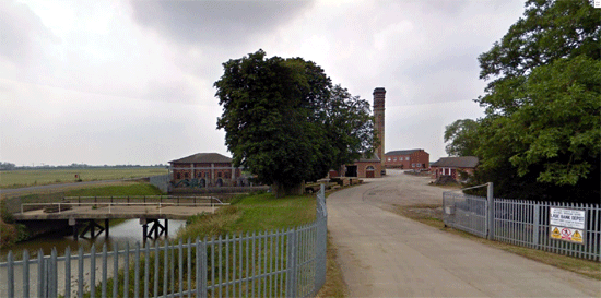
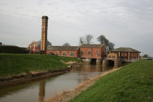
The pumping station at Lade Bank finally solved the problem of flooding in East Fen, although problems in the south still remained at The Witham Outfall that were not remedied until the improvements in the Acts of 1880 and 1884.
The following old picture shows just how deep were some of the drainage cuts in fenland.
The following old picture shows just how deep were some of the drainage cuts in fenland.
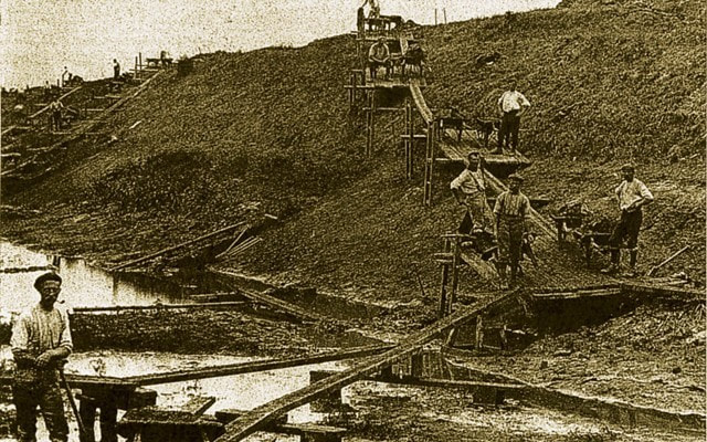
THE PRESENT DAY
The drains as they appear today remain very much the same as Rennie had planned. The current OS Explorer Map 274 (My MAPS 16 and 17) reveal just how successful the drains have been in keeping the fen dry.
The first map shows the two neighbouring villages of Toynton All Saints and Toynton St Peter with just below the East Fen Catchwater Drain.
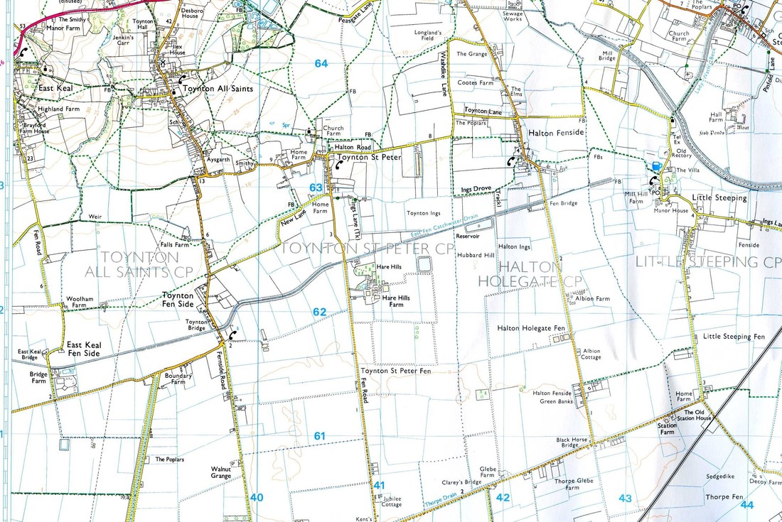
The Map below ( an extract that joins the one above) shows, on the left, the Hobhole Drain heading south, following Midville Road. Joining it lower down is the Bellwater Drain At the bottom is Lade Bank.
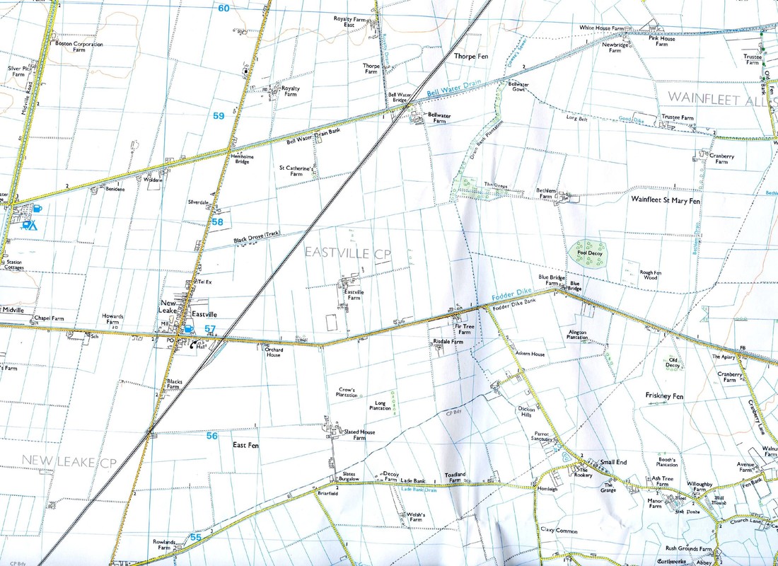
The picture below shows the East Fen Catchwater Drain as it is today.
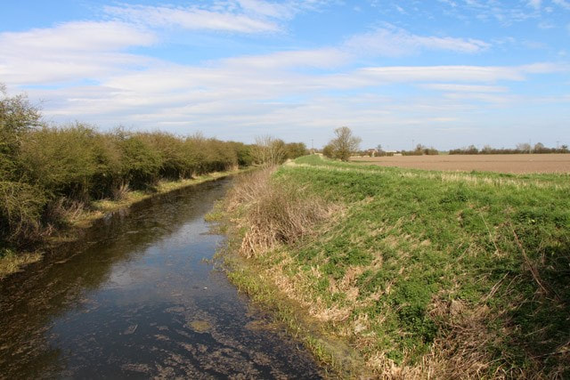
And next is my photo of the same drain as it heads south.
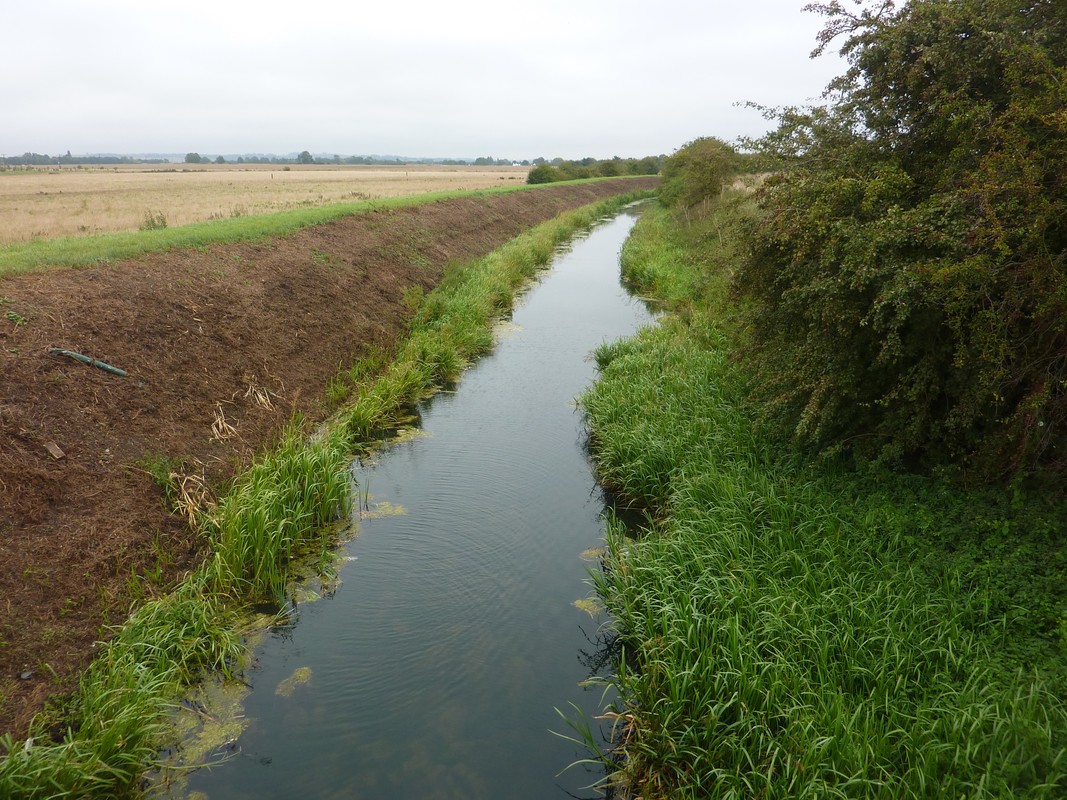
Next is where the Hobhole Drain meets the Bellwater Drain (See the Map above).
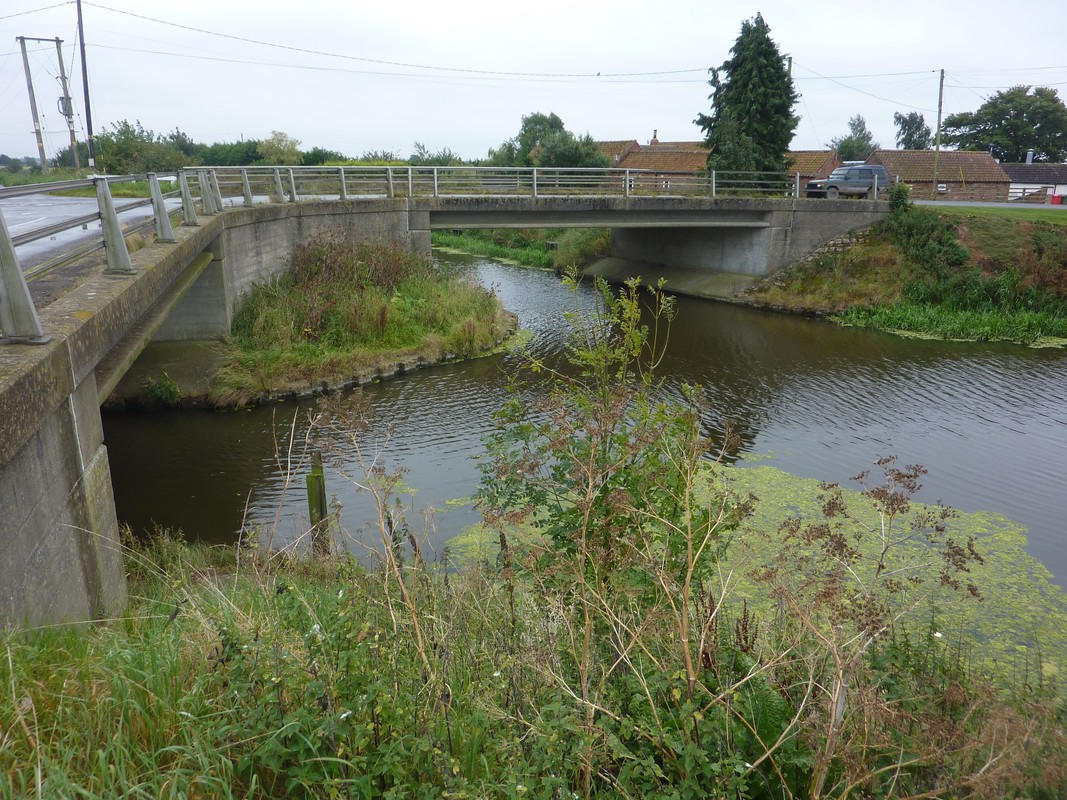
A modern map of those drains that are still navigable is by The Inland Waterways Association and called Witham Navigable Drains. (MAP NO 16 in the section MAPS OF EATS FEN). Note the Hobhole Drain is not navigable.
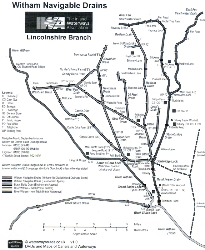
THE GREAT DEPRESSION OF BRITISH AGRICULTURE
Only had the drainage of the East Fen been successful in 1867 with the steam powered pumps at Lade Bank Pumping Station, that the Great Agricultural Depression set in. It is usually dated from 1873 to 1896. The depression was caused by the dramatic fall in grain prices following the opening up of the American prairies to cultivation in the 1870s and the advent of cheap transportation with the rise of steamboats. The Corn Laws had been repealed in 1846 owing to pressure form industrialists and workers for cheaper food from abroad. Grain and meat flooded in from North America, Argentina, Australia and New Zealand, undercutting British farmers. British agriculture did not recover from this depression until after the Second World War.
The depression also caused rural depopulation. George Ascough left Lincolnshire to work in the coalfields of South Yorkshire about 1872. The 1881 census showed a decline of 92,250 in agricultural labourers since 1871, with an increase of 53,496 urban labourers. Many of these had previously been farm workers who migrated to the cities to find employment. Between 1871 and 1901 the population of England and Wales increased by 43% but the proportion of male agricultural labourers decreased by over one-third. Every wheat-growing country imposed tariffs in the wake of the explosion of American prairie wheat except Britain and Belgium. Subsequently, Britain became the most industrialised major country with the smallest proportion of its resources devoted to agriculture.
In his book From Punt to Plough Rex Sly describes the period that followed as being still remembered in the fens “During the great agricultural depression village life changed, abandoned cottages…… a declining rural economy …… village life would never be the same again”.
WH Wheeler includes the following extracts from the Wilson Fox Report 1895:
The old fen cottages were built of ' stud and mud ' and thatched with the reeds which grew in the meres, the ' studs ' being the frame work of timber, which was filled in between with well punned clay mixed with chopped straw. They were very low and frequently consisted of only one storey, with two rooms, and sometimes I addition- a small room in the roof. They were very warm in winter. Many of these cottages are still to be found throughout the Fens. The modern cottages are generally good, well built, brick am tiled or slated structures, containing 2 living rooms and 3 bedrooms A great number have been erected during the last half century, and except in some of the remoter fens, the men have not far to go to their work. The cottages built for the fore men on the larger farms have more accommodation, as frequently the labourers hired by the year are boarded with them. The rate of wages for agricultural labourers in the Fenland has always ranged higher than in other parts of England, consequently the labourers, being well fed, are strong and healthy. They are as a rule intelligent, sober and hard working. The better class of work as thatching, hedging, and ditching, is frequently done by piece work by men occupying small holdings, who fill up their time by assisting the neighbouring farmers at harvest, and in doing work that requires skill. These small Occupiers are exceedingly thrift
and hard working and of very great service in the neighbourhood where they live. Horsemen, shepherds and labourers engaged by the year, if unmarried, are housed and fed by the farmer or boarded with the foreman. They are called ' confined men.'
The confined men are hired by the year. The hiring takes place at the principal market towns in May, the married men being usually engaged in February and entering their new situations a May-day. The single men and also the dairy maids and women servants were formerly hired for the year at May-day. The practice is, however, now gradually dying out, the hiring taking place through register offices, and the term of engagement being subject to one month's notice. The hiring used to take place in the open market place. At Boston and other towns, a public hall is now engaged for the purpose by the authorities. Women are not much employed on the land. In the last century they were reported to be better off in the Fenland than in any other part of the country. A great deal of their time was also occupied in spinning flax. They now generally assist at harvest, and in planting and getting in the potatoes, also occasionally in weeding and gathering twitch. In harvest time, the women and children are generally employed in gleaning in the corn fields, and collect about 6 bushels of wheat, and even up to 12 bushels.
From enquiries made by the Commissioner as to whether the Wilson Fox's labour was as efficient as it used to be, the replies he received were to the effect that 90 employers out of 100 were of opinion that the men did less work, and that, owing to the scarcity of able men, farmers had been driven to use machinery more, which was found to be less economical than good labour. The conclusion he arrived at, however, generally, was that labour in Lincolnshire was of very good quality, and that the farmers concurred in saying that it compared favourably with other counties. Some farmers expressed the opinion that they would rather employ a Lincolnshire labourer than a Norfolk or Suffolk man at is. And at another meeting h e was told that ' our men are very good, compared with other counties,' and that they had some of the best men in the world. He was further informed by a Contractor that the men he obtained from Lincolnshire were the best he ever came across.
LABOUR GANGS
The 1867 Gangs Act was introduced to prohibit the worst abuses; yet in 2004, when the Gangmasters Licensing Act was passed (in the wake of the Morecambe Bay cockle pickers tragedy), the government was still legislating against the evils of this system of employment. But even if large landowners were the main beneficiaries, many of the fenland smallholders managed to exact some compensation for the loss of their commons, and what they salvaged was productive land. The smallholder economy that characterized the area in medieval times survived, so that in 1870, and again in 1937, more than half of the agricultural holdings were less than 20 acres. In the 1930s the "quaint distribution of land among a multitude of small owners, contrary to expectations, had helped to mitigate the effects of the depression."
AGRICULTURAL CHANGES
By 1900, there were only a few reminders of earlier conditions in Fenland. Cole-seed or rape seed had died out, hemp had all but vanished and so had flax. Wheat, potatoes and sugar beet were now the main fenland crops.
THE EFFECTS ON THE ASCOUGH FAMILY
A report at the time sums up the predicament of the fen commoners:
The never-ending urge to master the management of water for agrarian purposes brought changes to the Fens, socially, economically and ecologically. For some an exciting (and profitable) new world, but for others the changes brought destruction to the way of life of generations, and a new breed of fenmen. They were needed to farm the large areas of newly cultivated land. The adventurers, who now owned large areas of the fens did not farm themselves and required new tenants for the land.
One can sympathise with the local inhabitants resisting the adventurers (who were given land for the expense of drainage) and foreigners. Many lost their smallholdings and rights through the combination of drainage and enclosure. Gone were the lakes (The Deeps) for fishing and fowling, reed and sedge.
It seems to me that it would have been around 1802 with the construction of the East Fen Catchwater Drain, that this would have cut off the inhabitants of the Toyntons from the benefits of East Fen. Were the family involved with its construction? It took many men to carry out these works. John Ascough was 43 years old and his son John was 20. By the time the elder John died in 1844, the East Fen had been drained (though not entirely satisfactorily) and enclosed. The commoner’s Open Fields around their villages had already been enclosed by the Enclosure Act of 1773 so I guess losing access to East Fen was nothing new.
James Ascough was born in 1808 and according to the 1851 Census he was by then an Agricultural Labourer. His son George was born in 1852 and at first, joined his father working on the land. But the family had lost their independence and had become employees of the landowners. They may have suffered badly with the Great Depression of British Agriculture. They were among the first to be hit by the depression, and the family dispersed far and wide. George had left around 1872, so he had seen the writing on the wall. But it is interesting to read about the quality of the farm labourers in the Wilson Fox report. George was one of these hard-working men and as such, became very successful in his new life as a miner in Rotherham.
